Bear’s Castle is an enigma. There is little agreement over why it was built, or its purpose, but it truly captures the imagination.
Bear’s Castle stands on the edge of the Yan Yean Reservoir, just out of Whittlesea. It’s one of those places I’d only seen photos of, so to say I was pleased to have a chance to visit earlier this year is an understatement.
Bear’s Castle is on lands run by Melbourne Water, due to the proximity of Yan Yean Reservoir, and it has gone through many uses in its life since it was built probably in the 1840s. So let’s start at the beginning, this is going to be a post with a lot of ‘possibles’ because so much is not known.
The best place to begin is with the man who gave his name to castle, John Bear. So who was John Bear?
John Bear came from a landed family in Devon. He emigrated to Australia with his entire family, servants, livestock and a few friends (they chartered a whole ship) in 1841. They arrived in Williamstown on the 20th of October 1841. Once arrived he set up as a stock and land merchant and then purchased land from the crown, an extensive 935 acres at Yan Yean (the reservoir was not built then). He built a homestead, and planted vines (one of the earliest vineyards in Victoria) and raised cattle. However, as a stock and land agent he worked mostly in the city so, somewhat unbelievably, he commuted back to Yan Yean on the weekends, leaving his younger son to run the farm.
I’d like to pause here to acknowledge that John Bear didn’t purchase uninhabited land. The lands around Yan Yean have been the home of the Wurundjeri Woi Wurrung people for thousands of years before colonisers like Bear arrived and claimed them. As far as I can find Bear was not involved in specific massacres, but by moving into the land and turning its use over to cattle and crops, he was dispossessing the Wurundjeri Woi Wurrung people. This is true of any Europeans, including my own family, who arrived in Victoria in the 19th century and began to acquire vast tracts of land.
We know Bear had a house built by 1842 because the family was held up by bushrangers that year. John Bear was away, but his wife and daughter were at the house and forced to cook the bushrangers dinner. They also apparently stole Bear’s best port. This incident leads to the first suggested reason for the construction of Bear Castle, as a refuge from bushrangers or even First Nations people (who it was feared may attack the new house and not without reason). There are a few reasons against this theory, the key of which is the distance between the house site and Bear’s Castle. It would have been a long dash through often hostile bush to reach the castle, not ideal as a quick refuge.
The most bandied about theory is that the castle was built due to an offhand remark by John Bear. The story is that two of his stockmen, possibly John Edwards and Thomas Hannaford- both from Devon, asked him what they should do while he was away for some months, and he flippantly replied, ‘build me a castle’. And thus they did just that. This is a story has been handed down, and is frequently accepted as the most likely reason for the construction of Bear’s Castle. It is definitely possible, as the castle is built out of cob, a traditional mud and straw building method from Devon, and it resembles follies that might have been a familiar site in Devon. You can see what it looked even more castlely in the c.1870 photo below. The people standing on the battlements are thought to be John Bear’s descendants.
Against this theory is how much time and effort the construction of Bear’s Castle would have likely taken. It seems extravagent to build on a whim. Additionally his family would have remained at the farm, it seems unlikely they would have been alright with their workmen building a castle when they could be undertaking more useful work. It could absolutely be a contributing factor though.
The castle was definitely finished by 1851 because the farm was renamed Castle Hill after devastating bushfires ravaged the area. These fires indicate another possible reason for the construction of the Castle, as a look out tower. This is probably the most plausible, the castle is clearly not built to be lived in long term (though the Duffy Family did occupy the castle for a short time in 1865 while a house was being built for them). But the top would have given commanding views across the landscape to watch for threats. Originally the battlements would have been reached by a ladder probably from the first floor. This first floor was probably no more than a mezzanine level that was used to access the battlements (which are no longer there) rather than a floor that was actually used as another storey. There isn’t really anything left of the floor, but there is a couple of piece of sugar gum which were most likely installed by Melbourne Water in the 1970s. They never finished installing anything more permanent.
The mezzanine was reached by stairs built into the castle wall.
So regardless of whether the castle was built as a refuge, a watch tower, a folly, or a combination there of, it was built and the history of the building itself is somewhat circumstantial but still interesting. It was probably built in the 1840s, most likely the late 1840s. It’s gone through many iterations. The walls are mainly cob, though what you see now as the exterior walls was done as a render with mud and chicken wire in the 1970s in an attempt to protect the building. You can see some of the exposed wire below.
The pitched roof that you can see now, appeared in a thatched form in the 1920s, but it was soon in extensive disrepair.
The roof was re-clad in timber shingles in the 1940s
Although the above photos are black and white, before its 1970s render the castle would have been grey from the clay it was built out of. Hidden beneath the 1970s render, as well as the original building material, are small details such as that the lancet windows were formed from inverted forks of gum trees. You mostly can no longer see the gums, but the inverted shape is distinctive.
You can see original materials peaking out from the 1970s render as well.
There is also a fireplace in Bear’s Castle
The chimney tower was built in the 1870s you can see how different it is from the other towers below
It’s the only extensive use of the bricks in the building.
Bear’s Castle’s survival is at least partly because it sits next to Yan Yean Reservoir which was constructed in the 1857 and is Victoria’s oldest water supply. When the reservoir was built it was the largest artificial reservoir in the world.
It was designed by James Blackburn, who was a civil engineer from England transported for embezzlement. It took four years to build, cost 750 000 pounds and has a capacity of 30 000 megalitres. Its status as a major source of water supply means that public access to Bear’s Castle has been restricted to protect the purity of the water. This probably contributed to both its survival, no chance to loot materials, and it’s obscurity; as even today you have to go on an organised, weather dependant tour to visit it.
Bear’s Castle is a unique survival, it’s the only cob building left in Victoria and is one of the state’s oldest. It stands for what were probably many cob buildings in the Yan Yean and Whittlesea area which have not survived. Whatever its purpose, it tells a story of an early pastoralist family bringing their history and traditions with them. Its very castle like nature tells of the hundreds of years of Eurpoean history imposed on the land. And if nothing else it is a mesmerising building.
Tae Rak, a wetlands environment which is part of the World Heritage Listed Budj Bim Landscape, is a remarkable place. Not only is it a place of evident beauty, but it a landscape that has been actively cultivated for thousands of years by the Gunditjmara people. The presence not only of eel traps, but the remains of dwellings, makes Tae Rak (and the surrounding Budj Bim landscape) one of the oldest examples of aquaculture in the world. This post is going to look at Tae Rak, the life cycle of the kooyang, or short-finned eel, and the Gunditjmara use of the land. There will as always be photos.
I want to stop here to discuss the privileges I am bringing to writing this post. As with other posts about Australia’s First Nations’ history and the landscapes that reflect it, it is important to understand two things. Firstly that I am not a First Nations Australian. I write these posts with no claim to special knowledge, I am reiterating the information from the guides on the day as well as some external research (see the references listed at the end). Secondly, that I am in the position of having benefited from the invasion and colonisation of Victoria’s First Nations people, both from my heritage and my job. The first of this is especially true when looking at Tae Rak, as it’s less than an hour’s drive from Port Fairy, a town that my ancestors founded on land that was stolen from the Gunditjmara. My ancestors were not specifically involved in massacres in the area, but that was largely a result of timing, they arrived too late, but they were definitely active recipients of the immediate dispossession of land. I am fifth generation Australian on both sides of my family, most of my ancestors arrived in the 1850s, and thus my ability to sit here comfortably on my laptop and write this post is a privilege inherited from 200 years of dispossession. I also work for a library, which are inherently colonial organisations, that privilege a western system of knowledge keeping and knowledge management. While we are doing what we can to rebalance those scales, it is a not a simple process.
So having said all that, why am I writing this post at all? The answer is because the history is fascinating and deserves to be more widely known, and if I can contribute to that even a little then that is worth it. Also the landscape is so lovely, and the stories so interesting that I wanted to have a chance to tell them.
The final disclaimer is that there is a lot that is not known. This is common across First Nations groups across Australia, due to colonisation, invasion and quite intentional destruction of knowledge. In Victoria is is especially true as First Nations people were forced off country into missions in the 1860s, and language and culture were actively banned.
So what is Tae Rak? It is the wetlands system known as Lake Condah to the Europeans. It is part of the broader Budj Bim Landscape in Western Victoria, which includes the (probably) extinct volcano Budj Bim. The landscape was cultivated and shaped by First Nations peoples for thousands of years before the invasion by Europeans. In recognition of this, it was World Heritage listed in 2019.
I wanted to begin by giving an idea of what the landscape looks like. It is volcanic, which is a key point. This whole area of Victoria was shaped from the eruptions that gave rise to Budj Bim about 27 000 years ago. Though Tae Rak was created by larva flow from an eruption about 8000 years ago. This all gave rise to the basalt landscape that you can see in the photos below.
Bud Bim is actually one of Victoria’s newest volcanoes. First Nation belief systems record the eruption, with Budj Bim being the head of the ancestral being who left behind part of themselves at the end of their dreaming journey, and the larva flow being the teeth. The same belief system tells of journeys of creator beings to near by landmarks, including to the south where Deen Maar (Lady Julia Percy Island) guards the final resting place of the Gunditjmara people when they die. You can see Deen Maar on the horizon below.
Essentially the Gunditjmara belief systems speak of a landscape, described by Eileen Alberts from the Gunditjmara, as left to them by the ancestral beings, with the resources to live a settled lifestyle. They had the dammed waterways, the stones and the rocks to build aquaculture systems and wetlands where reeds grew to make baskets, and the food enriched landscape to survive.
This was a land that was shaped and cultivated, lived on for thousands of years.
Geologically, what the eruption of Budj Bim 8000 years ago did was to dam the Darlot Creek, which through time and, what is now called Condah swamp working its way through the larva flow, created Tae Rak.
What you see today is only a fraction of the size of the original wetlands that the Gunditjmara used for everything. But, conversely, it is much bigger than what you would have seen even fifteen years ago. This is because the decision was taken to drain Tae Rak following severe flooding in 1946, work was completed in the 1950s, and Tae Rak became largely farming land. In 2010 a new weir was built to again create a facsimile of the dam created by larva flow thousands of years ago, and water was returned to the wetlands, though nothing to the capcity it would have once held. You can see the weir below.
First, though, to return to the purpose of the aquaculture systems that were constructed. And to understand this, I need to properly introduce an extraordinary creature- the kooyang, or short-finned eel. You can see some in the tank in the video below.
Now, saying eels are fascinating is not something I thought I’d ever be saying, but their lifecycle is truly extraordinary. The kooyang you see in the tank above are somewhere in the middle ish of this cycle. They can grow up to 1.1 meters long and live for 14 years for males and 18 years for females. They’ll eat most things, including any carrion that ends up in the water. When they are headed towards the end of their life cycle, they close over their anus to ensure they keep all their nutrition in, then they fin their way out of the wetlands, through river systems, and mud sometimes, out into the ocean. From here they fin their way up the east coast of Australia to the coral sea, a journey of thousands of kilometres, when there they, probably, dive down to the depths, explode, all the eggs and the sperm mix in the warm water and new eels are spawned. These tiny glass eels begin to make their way back down the coast of Australia where they follow the smell of freshwater back to Tae Rak, often climbing weirs, dams and waterfalls to make it, growing as they do so, to become a yellow eel and then ultimately a silver eel, before starting the whole process again when they’re ready to spawn.
These incredible creatures also make incredible nutritious food, and are the reason for the Tae Rak eel traps, though other things were caught in them too. Essentially the larva flows from Budj Bim created pockets in the ground which became pools and the Gunditjmara created channels between them to take advantage of seasonal changes in water height. They created these connecting channels between the pockets to move eels around to where they wanted them. These channels were created through solid basalt, probably through a combination of digging it out and setting it on fire and rapidly cooling it to make it crack and easy to remove. Some channels are more than 50 m long. They also made weirs to control the velocity of the flow of the water. There are deliberate narrowing points in channels, where traps made from reeds were placed to force an eel through a V which they couldn’t swim out of, and from where they could be easily harvested. These aquaculture systems were also used to ferry eels into larder pools where they would be kept for later harvesting. You can see one of the latter systems below.
The final image is the channel between the pools.
So, with this incredible food source, and aquaculture system, you needed somewhere to live. There are remains of permanent dwellings at Tae Rak. They were often built on the ridges, for the advantage of the vantage point. You can see the foundations of one below.
This particular house would probably not have been lived in all year round, but would have been occupied by the Gunditjmara when they were using the resources at Tae Rak, though this isn’t true of all First Nations dwellings in the area. They would not have been built entirely of stone. These domed dwellings would have been a stone wall topped with wattle and daub, and reeds. You can see some modern interpretations below (admittedly in a slightly decrepit state).
The image above is from the near by Tyrendarra Indigenous Protected area, which is about half an hour from Tae Rak and would have been a meeting and gathering place for the Gunditjmara. You can see one of the gathering place below with the foundations of dwellings, which unlike image from Tae Rak would have been communal and interconnected.
At Tyrendarra you can also see a further extension of the wetlands and the remains of the formerly vast reed beds.
I am aware I have been using the word ‘remains’ a lot, that is because quite often that is all we have left. The basic question of ‘what happened to all the stone dwellings’ is answered by the photos below.
Most of the stone was appropriated for use by the invaders, including through stone walls to mark out the boundaries of this land they were now claiming to be theirs. The wall you can see above is about 10 m from the first house. Now taking stone from old dwellings and repurposing it is something done the world over, there’s plenty of buildings constructed from Hadrian’s wall for example. The key difference here is that these dwellings didn’t just fall into disuse, the people who had been using them were killed or forced off their land, and no one ever tried to deny that Hadrian’s wall existed in the first place. Even today with mounting archaeological evidence, accounts from early pastoralists and surveyors describing large groups of Gunditjmara living in permanent structures, and the Gunditjmara’s own belief system and oral tradition, which is just as valid as any western version of history, the existence of these dwellings is denied, sometimes actively.
This sadly brings me back to where I began, the dispossession of the Gunditjmara. This isn’t intended to be a history of dispossession, invasion and colonisation of the Gunditjmara, as that would be a whole post on its own and I can not do it justice here. But have a look at my reference list at the end for more information. I will however give an overview. The key fact is that the Gunditjmara didn’t magically vanish, they fought for their land, their lifestyle and their people as did all First Nations people in Australia.
Invasion happened quickly. Major Thomas Mitchell (who I have written about before here) surveyed the Western District in 1836, and whalers and sealers had been moving up and down the coast. As more colonisers moved in, there was more conflict with First Nations people and more were killed, and more women were attacked. ‘Protector’, and not very nice man but avid diary keeper, George Augustus Robinson noted that some shepherds ‘appeared to devote more time to the native women than to their sheep’. The best known of these massacres in the area was a bit south and west of Tae Rak, where 20 Gunditjmara people were killed in 1834, known as the Convincing Ground Massacre. But this was not an isolated incident and violence did not remain the realm of whalers, sealers and surveyors. Pastoralists moved in and, by 1841, there were more than 88 stations between Geelong and Portland, many covering vast areas of land. And with the pastoralists came sheep and cattle who destroyed the natural ecosystems and the soil in their wake. The land that had been cared for by First Nations people for thousands of years was irrevocably damaged, as well as being stolen. This wasn’t a passive resistance to this invasion either, the Eumerella Wars fought in the 1840s were a sustained campaign by the Gunditjmara against invasion. The rocky Budj Bim landscape was an ideal place to wage war from. It was the use of native police, brought in from other parts of the country, that ultimately turned the tide against the Gunditjmara.
Physical violence was not the limit of the influence of the colonisers. The place names changed too, and the colonisers laid their own belief and world views and history across the landscape, shaping it culturally to match. The western name for Budj Bim is especially galling, as it began a Mount Eeles after a British aristocrat, but was bastardised to Mount Eccles which means absolutely nothing. By the 1860s First Nations people were being herded into missions, often not on their own country, and language and culture was being banned. It’s the equivalent in the Western world of burning the library and the museum to the ground.
For the Gunditjmara this mission was the Lake Condah mission, and while ultimately in some ways it became a place of community, it was in essence a place of control and many times punishment.
So this is a brief overview of the tangled web we are only just starting to beginning to untangle today. This brutal history must be understood and recognised as part of our own foundation myth. And First Nations histories and stories and perspectives must always be at the heart of it.
Today Tae Rak stands as a symbol of this. It is owned now by Gunditjmara, though they are still trying to buy back more of the surrounding land. This came about through a series of land mark native title cases, which sadly I don’t have the space to discuss here- again that might be another post. The Tae Rak Aquaculture Centre, again run by the Gunditjmara, is a starting point for cultural tours of this unique landscape, so the story of Tae Rak can continue to be told.
References:
Site Visit 2023
The People of Budj Bim: Engineers of aquaculture, builders of stone house settlements and warriors defending country / Gunditjmara People with Gib Wettenhall
Welcome to another iteration of Ragbag On Road. In this edition, you find me on the incredible Silo Art Trail in Western Victoria. Introduction below.
So, in this post I’m going to take you on a tour of the Silo Art Trail, its history and some of the history of the towns and the silos themselves. This post is part of a longer series, which also explores the integration of art and history. You can see more at the links below:
I won’t be including every piece of silo art in Victoria- as it has spread well beyond the original trail. But I have covered the original trail, with its newest additions.
Before I go anything further- I would like to acknowledge the First Nations people on whose lands these silos were built and art work created. A lot of the history of these towns I’ll be discussing is rooted in pioneers and Europeans discovery. For First Nations people, this is a history of dispossession and colonisation. These lands were not unoccupied with western people moved into them.
But what is the Silo Art Trail?
The Trail started with the painting of one silo in Brim in 2016. The premise was a local art project, with the collaboration of both the local community and an artist, to paint the silo to reflect the community. The project was so popular that the Silo Art Trail was conceived and now stretches over 600 km, linking small towns across the Wimmera and Mallee regions of Victoria and creating the largest outdoor gallery in Australia. I’d heard of the Silo Art Trail, but when I was in the Wimmera in August I was unexpectedly impressed by both the sheer grandeur and size of these art works (some are as much as 30 m high) but also how reflective of the local communities they really are. Each artist (and every silo is done by a different artist) worked with, and in many cases lived with, the local community to create something that helps to tell their story. Following the Trail is also a great opportunity to explore these fascinating little towns. So as well as the silos themselves, I’ll be including something about the local history of each town.
And to give you an idea of the landscape of the Malle and the Wimmera- you can see some photos below.
As you can see- it’s a land of big skies, agriculture and desert. There was a lot (and I mean a lot) of water when I was exploring, due to an unusually heavy rainfall. Though the large body of water you can see is Lake Tyrell (more on that later).
So the silos are- mostly- working agricultural sites. I’ll be leading you through them, much as I visited them because following the trail itself is half the fun.
So…
St Arnaud
The St Arnaud silos were painted in 2020 by Kyle Torney. Torney is a St Arnaud’s local and spent 200 hours on the work which is entitled ‘Hope’. It depicts a miner hoping to find gold, as his wife hopes to find the food to feed them all and the hope of the future of their child. The silos themselves are still commercially run and owned by Ridley Agricultural Products.
St Arnaud actually began life as a gold mining town. In 1855 a group of prospectors travelled to the area in search of a ‘new Bendigo’. And on a knoll in what became St Arnaud they found gold. The town grew rapidly with the registration of the claim, with people coming in from all over the world. Which can be seen in the Chinese garden which is part of the town, built in memory of the Chinese miners who came seeking their fortunes in St Arnaud. You can see it below
Over 20 000 people came to the goldfield that was (at the time) only 40 acres, much of it without any alluvial gold. Most were disappointed, but as the gold field was expanded, some were successful and these prospective miners needed supplies and thus the town began to grow.
Rupanyup
The Rupanyup silo was painted by Julia Volchkova in 2017. It’s reflective of the young people of the Rupanyup area, and their commitment to community through sport. The images are of locals Ebony Baker and Jordan Weidemann. Volchkova wanted to celebrate the community and the hope, strength and camaraderie of their young people. The silos belong to Australian Grain Export and are still in active use.
Another piece of fascinating Wimmera history is nearby Rupunyup too. The Murtoa Stick Shed (which you can see in the photo below) is an amazing survival of World War II grain surplus storage. I have written an earlier post about it too- which you can see here: https://historicalragbag.com/2022/08/15/ragbag-on-road-murtoa-stick-shed
The town of Rupanyup itself has its roots in agriculture. Settlers began to move into the area in the 1870s, taking advantage of the rich soil and flat plains to plant crops and run livestock. They also worked hard to fence what they saw as virgin territory as they laid claim to these new lands. It is worth pointing out again, that the lands were not in any way unoccupied. The settlers lived a remote existence, troubled by the lack of reliable water sources as well as the tyranny of distance. But eventually a town grew up, and Rupanyup remains very much an agricultural community today.
Sheep Hills
So we reach the silos featured in the video. Sheep Hills are GrainCorp Silos, which were built in 1938 and were painted in 2016 by Matt Adnate. Adnate wanted to illustrate the local First Nations young people and their connection to elders, community and country. He worked closely with the Wergaia and Wotobaluk communities and painted on the silo are Wergaia elder Uncle Ron Marks and Wotobaluk elder Aunty Regina Hood. The two children are Savannah Marks and Curtly McDonald.
The night sky represents elements of local dreaming and, overall, the silos tell the story of the transfer of knowledge from one generation to the next.
Sheep Hills itself is a farming community. By 1900 there was a thriving town, with a contemporary map showing: a school, four churches, sale yards, cemetery, dressmaker and boot maker, banks, blacksmith, green grocers, hotels, timber yard, butchers and the creamery. It’s also adjacent to Sheep Hills Station which was bought by the McMillan brothers in 1855 and in 1860 George McMillan built a homestead which he called Kingungwell (a name he apparently derived from the ‘king’ of the local first nations people- Aungwill). The homestead was a lavish affair, so much so that many local people called McMillan mad for doing things like: building entirely from Oregen timber and installing cedar cupboards, and constructing a tower and a croquet lawn. The homestead was demolished after WWII. Today Sheep Hills is a much quieter affair- but you can see the mechanics’ institute below.
Brim
The silos that started it all. Guido Van Helten’s multigenerational depiction was completed in 2016. Van Helten wanted to highlight the generations, both male and female, who have farmed this land and will farm it into the future. By rendering the figures as not entirely substantial Van Helten wanted to explore the shifting ideas of community identity and the difficulties faced by rural communities, especially in the face of climate change. The final message really hit home for me, as I was travelling through the area in a time of unprecedented, unseasonable rain levels. The interest that this silo sparked, was the flame that lit the Silo Art Trail, drawing people from all over the world to the Wimmera and Mallee regions.
Van Helten specialises in the painting of everyday figures in forgotten places and won the Sir John Sulman prize from the Art Gallery of NSW in 2016 for his work in Brim.
Brim itself is a rural community- with deep roots in community organisation. With active local sport clubs and community groups. One of the interesting historical markers just up the road is the netting fence which was erected in 1885 to stop rabbits and dingoes overrunning agricultural land to the south. The fence stretched to the South Australian border and the marker can be seen below.
Rosebery
The Rosebery Silos were painted by artist Kaff-eine in 2017. The silos themselves are GrainCorp and date back to 1939. Before she started painting, Kaff-eine spent time with Rone at the Lascelles silos (coming up soon) and touring the local towns and getting to know the communities. Depicted in the art work is firstly- the sheer grit and determination of the young female farmers of the region as they face fire, flood and drought, symbolising the future and, secondly, the close friendship between a farmer and his horse- symbolising the connection between the humans and the animals of these regional communities.
Rosebery itself is named after Archibald Philip Primrose the 5th Earl of Rosebery who became Prime Minster of the UK in 1894. Settlers arrived in the area from the mid 1800s and by 1895 Rosebery had a school, butcher, churches, greengrocer, undertake, saddler, foundry, billiard room and a wine saloon. Today Rosebery is a much quieter town, but it is still the heart of a strong farming community.
Watchem
Watchem is one of the newest additions to the Silo Art Trail completed by Adnate and Jack Rowland in March 2022. The artwork depicts two renowned harness racers- Ian “Maca” McCallum and Graeme Lang. McCallum drove 16 winners in one program in Mildura in 1985, making him a local legend, and Lang was sport’s best from the late 1960s onwards and trained the legendary horse Scotch Notch. The silo is currently in the middle of the disused basketball court- but will be moved to the main street.
Watchem itself has a slightly ghostly presence. It’s quite clear that it was originally a much larger town. Along with the abandoned basketball court, there is an abandoned oval, school and train station, as well as a very impressive church (not abandoned).
Watchem has been the victim of the need for more land to make farming profitable which has reduced the number of people in these off the highway settlements. Also as the population has continued to age, the amount of people living in Watchem has continued to shrink. The situation is was not helped by the drought years, which saw Watchem Lake (which attracted campers) dry up. Watchem began as a community serving settlers setting up farms and livestock runs. No one really knows exactly where the name came from, it was thought that it might have been a First Nations word, but no link had been found.The first official mention was in 1864 when the Land Board instructed the Surveyor to “lay off a direct line to Watchem.” Today there is still a community at Watchem, one that is proud of its heritage and hopefully the Silo Art Trail can help being people back to the town.
Nullawil
Nullawil silo was painted in 2019 by the artist Smug. Smug painted the work over two weeks in difficult wet and windy conditions. Made especially hard by the fact he was working on a cherry picker (as did most of the artists). You can get a feel for what the conditions might have been like when you look at the carpark during my visit.
Smug’s work depicts a farmer and his faithful kelpie. The work doesn’t depict a specific person, rather an amalgam- standing in for farmers across the region and their connection to their animals and the land.
The silos themselves were built in early 1940s and remain operational today along with the railway line which runs up to them.
Nullawill itself began as pastoral leases in 1849, the town now stands on what was the junction of the Knighton and Lansdowne runs. It was later divided into lots of 500-600 acres and they were leased for 2 pounds a year in 1891. The town grew out of the settlers moving to the areas to take up these leases. It was proclaimed a township in 1898 and you can see its immaculately kept central part below.
Sea Lake
Sea Lake’s silos were painted by Travis Vinson and Joel Fergie in 2019. The artwork is entitled ‘The Space In Between’ and tells the story of a young girl swinging from a eucalyptus over Lake Tyrell. They also link to the First Nations knowledge of astronomy, that has been recorded in detail in this area. Lake Tyrell is a special spot for astronomy and stargazing due to the lack of light pollution from nearby towns and the completely clear access to the sky (when there aren’t any clouds-which there were the night I was there). The art work also pays homage in colour to the vibrant sunrises and sunsets the region is known for.
The town of Sea Lake takes its name from its proximity to Lake Tyrell. Lake Tyrell’s name comes from the First Nations word ‘direl’ meaning sky. And sky is what you get. Lake Tyrell is the largest inland salt lake in Victoria- covering an insane 20, 800 hectares. It has been used for commercial salt production since the 1800s and is still today (though much more sustainably). The lake itself is thought to be the remains of when the seas rose many thousands of years ago and flooded what is now the Murray-Darling basin. When they retreated, Lake Tyrell was left behind. The lake is known for its reflective surface, mirroring the sky back up. When I visited it was very full of water and windy, so while I was able to appreciate the vastness and its beauty, especially with how much of the sky you can see unobstructed by land, I didn’t see the mirror affect.
Sea Lake was formed both from use of Lake Tyrell, but also from Tyrell Station which ‘taken up’ in 1847 by W.E Standbridge. It remains an agricultural community, with close ties to the lake.
Woomelang
I’m going to depart a little from my format so far for this section, because Woomelang does not have one large silo painted. They elected to have eight grain bins painted by different artists instead, creating their own little silo art trail, within the Silo Art Trail. So i’m going to go through each grain bin individually. They all reflect some of the local wildlife and were painted in 2020.
This bin was painted by Bryan Itch and depicts the pygmy possum. Pygmy possums are tree dwelling marsupials, who are nocturnal and so small they are very hard to spot. The main threat, even above introduced predators, is land clearance for agriculture. Itch says he chose the pygmy possum because he loves painting the hidden beauty of small things.
This bin was painted by Andrew J Bourke and depicts Rosenberg’s heath monitor, a terrestrial predator who lay their eggs in termite mounds and eat carrion, small birds, eggs, small reptiles and insects. Like the pygmy possum their main threat is land clearance. Bourke chose the heath monitor because they are inquisitive, confident and extremely intelligent.
This bin depicts the western whipbird and was painted by Chuck Mayfield. The whipbird, has a distinctive call like a squeaking gate- they have sadly been almost wiped out from the Mallee. Mayfield painted the whipbird to give it a bigger stage as so few people will have seen one in real life.
This bin depicts the spotted-tailed quoll and was painted by Kaff-eine who also did the Rosebery Silo. The spotted-tailed quoll is a mostly nocturnal predator who mainly hunts medium marsupials. Like the other animals so far, they are at great risk from habitat fragmentation. Kaff-eine chose the spotted-tailed quoll because she wanted to paint it with humans to illustrate the both the playful nature of the quolls but also the important human role in protecting the quolls.
This bin depicts the malleefowl. A uniquely Mallee bird, which is a ground-dwelling, shy, and seldom seen bird which mates for life. Artist, Mike Makatron, wanted to depict the life cycles of the malleefowl.
This bin depicts the lined earless dragon, a small mottled lizard who communicates with head nods and pushups. The dragon was painted by artist Goodie, who chose it because she has always loved reptiles, especially painting their scaled texture and she thought the dragon would sit well on the bin.
This bin depicts the Mallee emu wren, a diminutive bird native to the Mallee. It was painted by Jimmy Dvate.
This bin depicts both the Major Mitchell’s cockatoo and the south-eastern long eared bat. The cockatoo was painted by Bryan Itch and the bat by Chuck Mayfield. Major Mitchell’s cockatoo is an iconic Australian bird, now in decline (again largely due to habitat destruction). Itch jumped at the chance to paint it, to capture its feathers emblematic of the dusky Australian sunset. The bat is a micro-bat active at night, hunting with echo-location and roosting during the day in crevices and under tree bark. Mayfield wanted to paint the bat on such a large scale as they are so elusive to find.
So that’s Woomelang’s silos- the town itself? The earliest map dates to 1899 and by this time the town had a railway line, a hotel, a store, churches, and a school was being built. Today it remains a mid sized rural town.
Lascelles
Lascelles was painted in 2017 by Rone- who I have written about briefly in my look at his transformation of the Flinders Street Ballroom in 2022. You can read that here:
The GrainCorp silos at Lascelles were built in 1939. Rone worked specifically with the colours of the silos themselves to make it look like the figures are emerging from the concrete. Depicted are Geoff and Merrilyn Horman who are part of a farming family who have farmed the land for four generations.
Lascelles was originally called Minapre but the name was changed to honour of EH Lascelles of Messers Dennys, Lascelles, Austin and Co. from Geelong, who were seen as a mainstay of the local community. In 1911 an article called “the Progress of Lascelles” highlighted the town’s rifle club, theatre club, hotels, station, school, churches, banks, races, stores, sale yards, livery stables and coffee palace. Like most of the other Mallee towns discussed it rose to support the local farms and community.
Patchewollock
Painted in 2016 by Brisbane artist Fintan Magee- the 1939 GrainCorp silos show local man, and grain farmer, Nick “Noodle” Hulland. Magee lived at the local pub while painting and chose Hullund because he typified the no-nonsense hard working farmers and spirit of the region. He also had the tall and lanky build to fit well on the 35m high silos. As he squints into the distance, he is looking at the challenges of the life of a Mallee-Wimmera farmer.
Patchewollock itself was one of the, comparatively, later subdivisions of the Mallee lands. In 1910 the first areas of the Patchewollock district were made available for selection. A total of 55 blocks were on offer and the cost of water supply and clearing roads was added to the cost of the blocks. There were 240 applicants for the 55 blocks who had to go before a land board and explain why they thought they were eligible to be selected.
The name comes from two First Nations words putje meaning plenty and wallah meaning porcupine grass. So that gives you an idea of the landscape the first selectors were seeing.
Albacutya
Albacutya is one of the newest additions to the Silo Art Trail. It was painted by Kitt Bennett in 2021. He wanted to tell a story of growing up in the country. The boy depicted is the son of the owner of the silos and the woman is yabbying, a common pastime in Bennett’s own country childhood. The vibrant colour is partly in homage to the nearby town of Rainbow. Albacutya silos themselves are very remote, you can see the view opposite in the image below.
But the community of Rainbow is about twelve km away and it was this community that Bennett took his inspiration from. Rainbow itself is vibrant agricultural hub. The name comes from the hill that was covered in colourful wildflowers in springtime. It was originally called Rainbow Rise, but when the town was surveyed in 1900 it was shortened to Rainbow. You can see it in the photos below.
The name Albacutya comes from the nearby Lake Albacutya- which is one of Victoria’s largest ephemera lakes.
Arkona
Arkona is very newly finished- hence the awkward photo because it is on the edge of the highway on the edge of Dimboola with no signs or parking. It has been painted by Smug and is a photo-realistic portrait of local legend Roy Klinge who died in 1991. You can see Dimboola Court House- home of the Dimboola Historical Society in the photo below.
Goroke
Finished in 2020 the Goroke GrainCorp silos were painted by Geoffrey Carran. The word goroke means magpie in local First Nations language- so it was a natural choice for the artwork. He worked closely with the local community to decide what else to include and settled on the the kookaburra and galah- in front of a typcial West Wimmera landscape.
Goroke is the gateway to the Little Desert National Park. The first official selector arrived in the area in November 1874 with the lease of Allotment 1 of the Parish of Goroke for 192 acres. The town sprang from this. The rail line extension in the 1890s greatly helping its foundation. Today you can see the remains of Goroke’s 19th and 20th century heritage throughout the town.
Kaniva
We have reached the end of the trail. Kaniva is only a short distance from the South Australian border. The GrainCorp Silos were painted by David Lee Pereira in 2020. The Australian hobby bird (a type of falcon) and the plains sun orchid and the pink sun orchid (which generally only open on humid days) shine as examples of the desert flora and fauna surrounding Kaniva.
Kaniva itself is a border town, and that is the key origin of its foundation. Today as well as the silos it is home to an amazing sheep art trail, which encompasses sheep painted by the local community organisations. You can see them below.
And that brings me to the end of the Silo Art Trail. I hope you have enjoyed the journey along they way. And stayed tuned for future additions of Ragbag on Road.
I write this blog for free- but it isn’t free to run. If you are able to, I’d really appreciate it if you can make a small donation below to its upkeep.
The remarkable twelve story neo-gothic Manchester Unity Building opened in December 1932 in Melbourne, a gothic salute to the industry of the time and home to the Manchester Unity Independent Order of Oddfellows. The Order are inscribed on the bones of the building. From crests on the facade to the mosaic in the entrance. Everything in the building is an ode to the Order.
But who were the Manchester Unity Independent Order of Oddfellows? They were a friendly society- the closest current analogy would be the Freemasons. By 1932, when they opened the Manchester Unity Building, essentially they were operating as an insurance company- in fact they still sort of exist in the form of Australian Unity. And this purpose is the core of the reason for the drama of the Manchester Unity Building.
The 1930s in Melbourne were a time of economic depression, and what an insurance company needed more than anything else was a statement that would make people trust them, hence the Manchester Unity Building. It’s a wild celebration of industry and progress, a declaration that the Depression was ending. You can see this in the motivational decoration in the lobby.
The construction of the building was itself a spectacle. The previous structure was demolished at midnight on the 31st of December 1931, so the building went up in less than a year! This was due to the builder W.E Cooper and Sons promising to have it built in 11 months and signing a contract saying that for every day he was late he would forfeit 85 pounds. It is also due to the cheapness of labour (it was the Depression), apparently each day there were queues of potential labourers all the way down to Flinders Street Station. Whatever the reasons, the Manchester Unity Building went up at an astonishing one floor a week on average. This all meant that the light on the top of the tower, proclaiming it open, was officially lit by the Premier of Victoria on the 12th of December 1932 at a banquet with hundreds of guests. The tower was lit on Friday and Saturday nights and actually serves no practical purpose. It is a void because buildings at the time could be no more than 40 m high, but towers and flagpoles didn’t count. With these additions it reached a soaring 64 metres, the tallest building in Melbourne for a time. The tower has been refurbished and is now lit every night.
And ultimately, it’s just the sort of the building that needs a tower.
The Order didn’t scrimp- this was building on the grand scale. And it had all the modern conveniences. The Manchester Unity was the first building in Melbourne with an escalator. Thousands visited to view the escalator when the building opened.
The elevators were also a marvel- travelling to the 12th floor in just 15 seconds- so fast that some of the genteel ladies apparently complained that the speed made them wet their pants.
The interior of the building was also exotic, boasting a rooftop garden, with ponds, palms, an aviary and flowering maples. There was arcades of shops on the first floor (reached via the escalator) and you can some of the original spiderweb wrought iron that was the balconies for the arcades below.
There were also modern conveniences that were less beautiful as well, including the first air conditioning system in Melbourne. It worked by having a large pool of water below the basement and using fans to blow the cool air off it up through ducts (which still works) and into the rest of the building. In later years, the basement was home to the South Seas Restaurant, a Polynesian themed restaurant including crocodiles in tanks. There is a story (which I can’t find a definitive source for-but it’s such a good story that i thought I’d share it anyway) that the crocodiles got away one day, and ended up in the air conditioning pool, before being relocated to Melbourne Zoo.
From early on, the first floor was home to Patches clothing store. Its windows faced onto Swanston and Collins Streets and all the new dress designs were displayed in the windows- an arbiter of taste for many Melbournians. You can see an advertisement for Patches below (from 1932), along with the current room, refurbished beautifully to house a dental reception room.
The crowning glory, and the epitome of the Order, is the Board Room on the top floor of the building. It is the definitive Art Deco room. It has been beautifully restored by Dr Kia Pajouhesh of Smile Solutions, who owns level 10, some of level 8, the cafe, level 11 and level 1. It is his work that has spearheaded the restoration and preservation of much of the building since the 2000s. The Board Room has survived the depredations of time (it was part of a private apartment for a while) partly due to its incredible table. It’s nearly six metres and made of Queensland maple. The glass is a single piece, which was brought in from the UK and was lowered in before the ceiling was put in. It is literally impossible to remove the table from the room. You can see the Board Room with its majestic table below. The shoes were found in the wall in the restoration process- and probably belong to one of the original builders- putting boots in the wall is an old tradition.
You can just see the Order seated around their specially built Board Table at the top of their magnificent towered edifice- an ode to progress and modernity. In fact you can actually see them below.
But despite the grandeur, the fanfare and how engraved the Order is on the building (literally) they didn’t occupy it for that long. The Department of Defence took over some floors during the Second World War- and then the Commonwealth Government compulsorily acquired the whole building in 1946, in a move that the Order described as a “bombshell”. The aim was to consolidate government departments in the building. Over the years, as well as government ownership, the building has been home to countless small shops as well as private apartments. Today many retailers work out the building and restoration projects have been running since the 2000s, headed by Dr Kia Pajouhesh of Smile Solutions who, as mentioned above, owns several of the floors. The surviving details that have been lovingly restored or recreated is truly amazing. You can see some of it below.
The filing cabinet you can see above is two way- the other side in the photo immediately above- and it’s largely original. The ongoing history of the building is not without its dark patches. The darkest of which was the murder of three jewellers in the building in 1978. I won’t go into details, but if you want to know more you can find the story here.
The story of the Manchester Unity Building is ultimately one of community; from the Order of Oddfellows, to countless small shops and retailers, to the hundreds of Melbournians who have taken the building to their hearts. It will always be a true Melbourne landmark- in all of its ridiculous glory.
So, my post of Flinders Street Ballroom from 2021 needs an addendum. You can read the original post which looks at the history of the ballroom and the amazing Patricia Piccinini exhibition here:
But I’ve just been back to the ballroom (which I was very excited about) for a new exhibition which uses the space with such different and majestic grandeur that I wanted to update my blog. The exhibition is call Time and it is by Rone.
Rone is best known for his large scale murals, usually of people. These include the Lascelles silo in country Victoria, which you can see below, and which I will cover as part of my blog on the silo art trail in the not too distant future.
In Time Rone has taken the Flinders Street rooms, including the ballroom, back to an imagined past suspended in time. It’s like walking into a globe of amber. While the set up of the rooms do not reflect their specific use, they are an ode to the post World War II landscape of Melbourne and the people who lived in it. It’s almost like being haunted, but you are the ghost- in a good way. It transcends time. I won’t go into more detail as the pictures below speak for themselves. If you want to know more this is the link to the exhibition: https://rone.art/ and it’s well worth seeing. So enjoy the photos, it is truly remarkable, especially the intense detail.
It’s hard to believe it is the same space as Piccinini’s Miracle Constantly Repeating- though you can see the same bones. I love how transformative art can be, breathing life into rooms that had been relics and giving them a chance at a new story.
I’d like to begin this post by acknowledging that Murtoa, the town I’ll be talking about, is on the lands of the Jadawadjali people. It always was and always will be Aboriginal land.
Welcome to another addition of Ragbag on Road. As you can see from the above video- in this iteration you find me in the incredible Murtoa Stick Shed.
To give you some context, Murtoa is a town in the Wimmera region of Victoria. You can see it on the map below.
And as you can see from the photos below it isn’t a large town.
The Stick Shed from the outside is certainly not remarkable.
But inside it is glorious
What makes the Stick Shed so remarkable visually is its sheer size (which doesn’t quite translate in photos). It’s 270m long, 60 m wide and 19 m high, and it is made up of 560 unmilled poles, hence the name ‘Stick Shed’, officially it is called the The Murtoa No.1 Store. You can see a photo of me in the Shed below to give you some concept of scale.
But the Stick Shed is more than a folly of sticks. It had a purpose and stands at the heart of the agricultural history of the region, which is why it was added to the Victorian Heritage Register as number 101 in 1990.
So what is that history?
For that we’ll need to go back to the beginning.
The genesis of the Stick Shed lies in World War Two.
Prior to the war, Australia’s main grain export market was Europe, and Great Britain specifically. With the advent of war, and subsequent threat to shipping, this market dried up and when Japan joined the war in 1941 any attempts to expand into the Asian market was kiboshed completely. The situation wasn’t helped by the fact that there was a wheat glut as well, especially in Western Australian, so the wheat could not even be used domestically.
So the Australian Wheat Board was faced with the question of what to do with all the extra wheat? The silos were already full, they needed another option. So they started building massive grain sheds in WA (the glut reached capacity there first). They were successful, so the local Grain Elevator Boards in Victoria decided that they needed one too. Murtoa was selected as the best site. This form of mass storage wasn’t a universally popular decision, with opposition from some labour forces and the (surprisingly) influential jute bag industry.
But why Murtoa?
It’s actually a fairly simple answer: Murtoa was in the middle of a wheat producing region, it had major rail and road connections, the local town conveniences needed and was at the confluence of another rail line that fed grain to the North.
Alright, so we know what the point of the Stick Shed was, and why in Murtoa, but how did something so practical come to be so remarkable? The first reason is the sheer size needed, as discussed above, and the second is the decision to use unmilled timbers. The choice of timber was determined by a shortage of steel. The timber is mountain ash hardwood, and it all comes from Victoria. Mainly the Otways, Gippsland and the Dandenong Ranges. There is an astonishing 2000 tonnes of timber in the structure. What is even more astonishing is the speed with which the Shed was constructed. It was built in only 4 months, starting at the end of 1941 and opening on the 22nd of January 1942 when the first bags of wheat were deposited by local farmer Maurice Delahunty. The first railway load of wheat arrived in February and by May/June the Stick Shed was filled with 3,381,600 bushels of wheat. The wheat remained undisturbed until 1944.
The Shed was built largely by hand (it’s a testimony to its importance that the government managed to provide a large workforce in war time). The poles were carted in from all over the state and erected in the hard Wimmera clay largely using trucks and A-frames- no big machinery. You can see some photos below that give you an idea of the process.
One of the key features that differentiated the Shed from others was the concrete floor, others had tin that failed to keep out the vermin and was impossible to keep clean. The floor contributed significantly to the Shed’s longevity. The floor is nearly 4 acres and was laid around the poles first. As the poles were put in the 4 foot deep holes, the aggregate concrete was poured around them at about 4 inches thick, this was continued as the Shed was constructed. You can see the result below.
At this point I’d like to cycle back to the poles themselves. The ‘sticks’ that give the Shed its name. As I said they are mountain ash hardwood and unmilled, but they are also largely original. You can see their very tree like nature below.
Some have been shored up with bow trusses, that effectively act as bracing the same way that rigging helps brace a ship’s mast.
The footings have had to be replaced in some
And sadly a few have had to be replaced with metal, for safety reasons. There really aren’t many though.
I also really like that you can see the notes on the poles for their maintenance.
Overall the effect is mind-blowing.
It isn’t only the floor and the sticks, the roof is also fairly astonishing
The roof is iron, and covers 1.5 hectares, with over two hectares of actual iron when you take into account the roof slope.
The side walls are also made of iron, with over all nearly five acres of iron going into the Shed. And remember this was WW2 where metal was scarce, which just exemplifies the importance of the Shed. You can see some of the walls below.
That’s the bones of the Shed, how it was built and why. But let’s have the body, how was it used?
The above photo gives you an idea of how the wheat was piled up, but how did it get in there?
It’s actually a fairly simple process. Most of the wheat came in by train, and it was loaded from the sidings. The photo below is the current Murtoa station, you can see the Shed on the far left in the distance.
The grain was loaded on to an elevator which fed the grain into the Shed- you can see the elevator below.
Once in the Shed it was fed onto a conveyer belt that ran the length of the Shed.
Once on the conveyer belt, simple barriers pushed the wheat off into the area of the Shed it was needed. Some people power was required too. There was a worker on the walkway next to the conveyor belt to make sure the wheat was going to where is was supposed to be and one on the floor. The Shed could also be filled by individual farmers from a hopper at the opposite end to the elevator.
The pit was finished in 1947 and extends under the Shed a bit. Farmers could dump wheat either by hand or from a grain truck if they had one, it was then moved into the Shed proper.
Once the grain was in the Shed (it could take an astounding 92000 tonnes) it was largely left alone. It was treated with insecticides by people walking on the top of it when there was an infestation, but it is specifically built with the concrete floor and windows all along the side alleys and ventilators in the roof, to keep infestations to the minimum.
But the wheat didn’t stay in the Shed indefinitely. It was emptied (when needed) with sort of a reversal of the whole process. There were horizontal conveyer belts which helped move the wheat to the side of the building. People were also on hand to operate these belts.
The wheat was conveyed to the south wall, where a belt ran the length of the Shed and trundled it back out of the Shed and on to trains to be sent wherever it was needed.
The wheat in the Shed, as it came from so many sources, was classed and sold as Fair to Average Quality (FAQ).
The Shed was used until 1989, when the Grain Board declared it uneconomical. It was added to the Victorian Heritage Register in June 1990.
So now you know the story of the Stick Shed. Although it is no longer used for the purpose it was intended for, it not only stands as a monument to the history of agriculture in the area, it is a truly spectacular building in its own right.
One thing you do really notices standing in the Shed, is that it is not a silent building. Part of this is because it is still very much in a working agricultural area.
But it is also because the Shed moves, you can hear it shifting and settling, it’s almost elemental.
The Stick Shed is also not the only historically interesting feature of Murtoa. The Murtoa and District Historical Society is housed in the old water tower.
The water tower was built in 1886 for the nearby rail line. It now houses an eclectic museum, the unexpected highlight of which is a remarkable taxidermy collection. It is the work of local minister James Hill and spans 1875-1932. Hill had contacts with missions in Africa, Brazil, India and New Guinea and asked for specimens in return for donations to the missions. He also swapped with other collectors, as far away as Africa. There are over 600 specimens, and it’s one of the largest collections of its type in Victoria outside of Melbourne Museum.
So the Stick Shed does not stand alone. I just wanted to finish with the note that the Stick Shed’s survival, when other large grain stores were demolished long ago, is down to intensive effort by individuals and committees. It has survived, in-spite of the odds against it. And I think we can all agree it was definitely worth saving.
I first heard of Caroline Newcomb and Anne Drysdale on a history walk of queer St Kilda. Neither lady has a connection to St Kilda, but there was general discussion about queer stories and history that doesn’t have a wider audience and they came up. Then, the same way when you buy a red car you see red cars everywhere, I came across them again only a week later at a talk on the history of Victoria in 100 LGBTQIA+ places, and the report that the talk was based on. Caroline and Anne featured together, along with the mourning brooch of Anne and Caroline’s hair woven together that Caroline had made in remembrance for a Mrs Thomson after Anne died. It is a thing of real beauty and you can see it below.
The brooch is held at the State Library of Victoria and I will come back to it a little later.
But to return to the beginning. Who were Caroline Newcombe and Anne Drysdale, and why have I decided to write a blog post about them…?
Anne Drysdale
Anne was born in 1792 in Scotland. Her family were middle class farmers and business people, but very unusually for a woman at the time she chose to go out on her own. She rented a large farm in Ayrshire from the 1820s to the mid 1830s and lived in Craufurdland Castle where she became a close friend of the family. She came to Australia in 1840, ostensibly for her health (though her ‘cough’ disappeared mysteriously quickly) determined to be a squatter not a squatter’s wife. She had money from small inheritance from her father and some other sources, and quickly secured the rights to land to run sheep that belonged to Dr Alexander Thomson on what is now the Bellarine Peninsula. She was 47 when she arrived. There is no surviving photo of Anne that I could find.
Caroline Newcomb
This image is found loose in Anne’s diary in the State Library of Victoria. The library kindly scanned it for me.
Caroline was born in London in 1812. Her family were merchants. She had a slightly itinerant early life as she was brought up in Spain with her father, but when he died she returned to England to be raised by her paternal grandmother. There isn’t much known about her early years, but she sailed for Van Diemen’s Land in 1833 also ostensibly for her health. She wasn’t part of the cadre of women brought over to be wives for settlers. In fact there is no indication she was seeking a husband. In Van Diemen’s Land (now Tasmania) she met Dr Alexander Thomson and his wife and became governess to their daughter. She sailed with them in 1836 as part of the Port Phillip Association’s journey to what would become Melbourne in what would become Victoria. She was one of only 35 women in a settlement of 117. She probably started the first school in Melbourne. In 1837 she moved to Geelong with the Thomsons where she could meet Anne, who came to stay with the Thomsons in 1840. You can see Geelong in relation to Melbourne below
I want to pause here to make one very clear and important point. The land that Anne and Caroline were arriving on was not empty. It was occupied by Australia’s First Nations people. This is especially important in the case of Caroline. The Port Phillip Association’s expedition was based on John Batman’s ‘treaty’ which was with the Wurundjeri people and which is incredibly problematic. The ‘treaty’ he drew up was not worth the paper it was written on. I won’t go into all the details as to why, but you can find out more here https://ergo.slv.vic.gov.au/explore-history/colonial-melbourne/pioneers/batmans-treaty.
This is also true of Anne and Caroline’s settlement on the Bellarine Peninsula. Anne came over to Australia operating under the concept that there was all this free land available. It wasn’t free. It was occupied, on the Bellarine Peninsula, by the Wathawurrung. The movement of settlers, like Caroline and Anne, into these lands continued the process of dispossession, invasion and colonisation. The Wathawarrung and the Wurundjeri (along with all First Nations people) suffered immensely at the hands of settlers and the Crown, dispossessed of their lands, killed and forced into missions off Country, their languages banned. This is the story that needs to be told alongside any ‘pioneer’ narratives of this period. Anne and Caroline were not moving into virgin territory.
The other point I need to raise here is Anne and Caroline’s relationship. As you’ll have realised from my opening Anne and Caroline were in a relationship. The nature of this relationship has to be considered through the lens of how they themselves would have viewed it. For example neither would have described themselves as lesbians, it wasn’t a term that they would likely have been aware of. But they were committed lifelong friends and partners, in business and life. We know most of what we know about them from Anne’s diary which has survived in the collection of the State Library of Victoria. I’ll be using the diary to tell the remainder of Anne and Caroline’s story. In it in 1841 Anne describes Caroline as “Miss Newcomb who is my partner, I hope, for life, is the best & most clever person I have ever met”. The diary quickly begins using ‘we’ and ‘our’ language, Anne describes her and Caroline’s life together. They lived together, built a house together, ran the farms together, shared a bed (though this wasn’t uncommon in the era) and were buried together, even though Caroline died 21 years after Anne and had married in the meantime (Caroline was 20 years younger). They were in a committed life long relationship, by any definition, but they were not the Australian equivalents of the infamous Ladies of Llangollen . This is in no way intended to dismiss the importance of their relationship, it is just to clarify.
So this brings us back to why I decided to write about Anne and Caroline. They were both unusual in their time, both for their relationship and in the roles they chose in life. Known as the Lady Squatters they were a novelty in their own time, but they were also pillars of their community, innovators and remarkable women in many way. Theirs is also just such an interesting story, I felt it fits right in with Historical Ragbag.
The other key reason I wanted to write about Anne and Caroline was the incredible house they built. I will come back to it when I continue their story, but I wanted to highlight it here. Coriyule was built for Anne and Caroline in 1849- it’s made of Barrabool Sandstone and is fantastically eccentric as well as beautiful. I was lucky enough to be able to visit and take photos and I want to give my heartfelt thanks to Isobel and Bryce, the current owners, who were kind enough to show me around their incredible home and to let me take photos. You can see Coriyule below, but I promise there’ll be more pictures later.
But let’s return to Anne and Caroline’s story first. We left them meeting in 1840. But how did this come about? Caroline had moved with the Thomsons to their sheep run at Kardina House (on the edge of Geelong) in 1837. The house Dr Thomson built is still standing, you can see it below.
Caroline was their governess. In 1840 the Thomsons were in Melbourne and they met the newly arrived Anne Drysdale. She was looking for land and sheep, Dr Thomson offered to give her one of his runs for lease. She came back to Kardina with him, to stay and to look at her new run. Her diary describes it as “Doctor drove me to see my future station, with which I am well pleased.” Anne stayed with the Thomsons while she got things sorted. And when she moved into a small stone hut on Boronggoop, her new 10 000 acre run, in 1841 she wasn’t alone. She’d invited Caroline Newcomb to join her and thus began the partnership that would last the remainder of Anne’s life.
Boronggoop wasn’t far from Geelong and Anne’s diary is a parade of visitors, especially as Caroline and Anne continued to teach some of the neighbourhood’s children. They were also both extremely devout and hosted an array of ministers and held religious services. They also took people in, including two of John Batman’s children (who were left virtually destitute after his death). At one point there were thirteen people sleeping in the hut. It’s clear that the ladies were a little bit of a novelty, with people visiting to meet the ‘Lady Squatters’. What the diary highlights more than anything else is the strength of their partnership. They arrived in August 1841 and by December ‘Miss Newcomb’ has become Caroline and the diary gives a lovely picture of how they worked. Caroline is a veritable dynamo, she’s always riding somewhere, or growing something, or building things (an energy that Caroline would carry all her life). Anne was definitely involved, but not always as physically (she was twenty years older), she keeps the practical background side of things going and the business side. It’s worth noting that the holding was Anne’s, Caroline didn’t bring money to their partnership. Their mutual respect and reliance on each other is clear, with Anne declaring how dismal it would be to be to always have to dine alone (on one night when Caroline wasn’t there). The diary is full of domestic detail of running a sheep property and their house, like the ‘tolerably good piano’ they managed to acquire and the 47 sheep who go missing much to their shepherd’s distress. They embarked on this journey together with real optimism, summed up by Anne declaring shortly after they moved in “I think with the blessing of God, we have every prospect of being very happy here.”
By 1844 they were without doubt happy, but were looking for more space having outgrown the hut. Anne also wanted to own her land not just be leasing it. She described the end of three years at Boronggoop as “We certainly have not made any money, but we keep out of debt & have much cause for gratitude to the Almighty who has furnished us with all things needful & and enables us to be to useful to many of our fellow creatures. We live very happily & have no wish except to have a piece of land & a stone cottage.”
So this stone cottage brings us back to Coriyule. Though, as you’ll have seen from the photo above, Coriyule is no cottage. Anne and Caroline were determined to own land and they took a deliberate camping holiday at Coriyule in 1846 to test it out. They returned “determined if possible to buy Coriyule.” And buy they did, they had obtained the lease for some of the land in 1843 but secured the free hold in 1847. This is where we hit a very frustrating gap in the diaries. There is one missing volume and unfortunately it is the late 1847-mid 1851 which was the years that they had Coriyule built and moved in. So we don’t have the detail we do about the rest of their lives. What we do know is that they commissioned the house to be designed by Charles Laing in 1849, and the plans are signed by both Caroline and Anne and in both their names. You can see them below.
We also know that a builder named John Henderson was contracted for the sum of 219 pounds to build the ‘cottage’. You can see the first page and final page of the contract below (including Anne and Caroline’s signatures).
Anne and Caroline probably moved in, in late 1849 (quite likely while the house was somewhat of a building site). So apart from the fact that it is one of the earliest houses in the district and built for Caroline and Anne, why is Coriyule special? It really is a remarkable house. It’s built with a basalt foundation, with the walls a mixture of sandstone, ironstone and others with the windows and chimneys dressed in local Barrabool sandstone. You can see the windows below.
In the images above you can also see the incredibly unusual windows frames as they are made from cast iron. Local legend is that this extra strength was to protect the ladies from any possible attack. You can see that the windows were an integral part of the original design in the plans for your reference below.
On this note lets take a step back from the small detail of the house to look at it a bit more broadly. You can see its beauty and idiosyncrasy below.
One of the other quirks you can see above is the roof. It’s made of galvanised iron tiles, possibly the earliest use of galvanised iron for roofing in Victoria. It was very much built for Anne and Caroline. It’s split level with a kitchen area downstairs (where you can still see the original bread oven).
A maid’s quarters was accessed by a ladder from this area (now accessed from an incredibly steep stairway- which was probably installed while Anne and Caroline owned Coriyule)
There is a set of stairs that provides access to all levels of the house
The middle level was the one used by Anne and Caroline (including the room they shared) and is truly incredible. As well as smooth heavy walls, there is an octagonal lantern, used for light and ventilation. I’ve never seen one outside of the a cathedral before.
The house is gothic revivial and it really shows it.
The doors are have been brushed with a comb to make them look like they’re oak.
It’s a little hard to make out in the photos, but there are two levels in the main house. The upper areas are less ornate than the main area, and it’s possible to lock the main area off. It’s likely the reason for this addition was the sheer number of long term houseguests that Anne and Caroline put up. Coriyule was twelve miles out of Geelong so if people came to stay, they stayed. Like their hut, visitors were clergy, local worthies, friends and people visiting from Melbourne. They continued to host children too, including again the Batman children, and the story is that Ellen and Adelaide Batman painted the flowers that survive on the door you can see in the picture below.
Other original survivors in the upstairs area include a fireplace with the original paint
As well as most of the interior walls and doors. Coriyule is very much a house that has been lived in. From remnant wall paper, to a mysterious ship called the Nelson etched into the plaster wall.
There is also an incredible cellar that runs beneath the whole building.
You can see some of the hooks in the ceiling that show it was used for hanging and preserving food.
Currently Coriyule sits in 40 acres of land, with extensive gardens and livestock. You can see some of it below. None of the garden is original, apart from the occasional tree such as the Port Jackson fig in the second last photo. You can also see the original water tank in the last image.
Although this is large, it’s a fraction of the land would have been when Coriyule was first established. Some of that land is part now part of Drysdale, named for Anne. When Isobel and Bryce bought Coriyule in 2007 it was in severe disrepair and completely overgrown. They have done an incredible job of rebuilding the house, using original materials and methods, and establishing the garden. There would have been an extensive garden when Anne and Caroline owned the house. A lot of the diary entries are recording what they plant when and what they did with it. Most of the garden sadly hasn’t survived, but Isobel and Bryce have been using the diaries to determine some of the plants that might have been there. The photo below of the gardeners cottage, gives you an idea of the state the house was in.
So I hope it is clear just how remarkable Coriyule is. It’s registered on the Victorian Heritage Database and I wanted to include the citation as I think it gives a really clear outline of why Coriyule is so important
“As one of the earliest and finest homesteads in Victoria. Its picturesque Gothic Revival style was not common in Victoria, particularly in country areas. It is significant as an important early work of the celebrated colonial architect Charles Laing. This asymmetrically planned mansion with unusual entry hall and stair-case has few counterparts in Australia.
Coriyule is historically significant as a reminder of the partnership of the women squatters Anne Drysdale and Caroline Newcomb, who were important in the history of squatting in Victoria. It is a remarkable reflection of the close involvement of women in a pioneering pastoral enterprise.”
So now we have explored Coriyule let’s continue with the life Anne and Caroline lived there. They had more crops and less sheep than their previous run and, as they were twelve miles out of the Geelong, Caroline couldn’t ride in everyday and visitors just dropping around was less common, though as I’ve noted above plenty stayed longer term. Anne’s diary from 1851 is the working life of a farm. They dealt with the labour shortage brought on by the gold rush, they planted roses and fruit and vegetables, they commented on the weather, they complained about the state of the roads and they continued with their close partnership. Then on the 8th of July 1852 about breakfast time Anne “was seized with a stroke of the palsy in the right arm & leg and she fell down in the parlour.” Anne convalesced at home with Caroline and did slowly recover, but Caroline took over the diary for about a month. Caroline’s entries are more succinct, never giving anything beyond the basic detail. Though you can see her excitement when Anne was up to weeding in the vineyard as she includes a rare !! after the exciting news. Anne took back over the diary in August and they continued their life at Coriyule. With Anne recording on December 9th after they return from a holiday at Kardinia that they are “happy to get back to our own dear house.”
Caroline takes over the diary again on the 16th of February 1853, with the faint note “Here ends Miss Drysdale’s journal.” On the 9th of April Anne has another stroke and this time she’s not so lucky. In a terse note on the 11th of May Caroline records “Fine. Men as yesterday. At noon Miss Drysdale was taken suddenly ill. I sent Frank for Dr. Bailey, but before he returned, she expired at 2 o’clock pm.”
This was the end of the extraordinary partnership between the two women. This incredibly brief line shouldn’t be taken as indicative of a lack of feeling on Caroline’s behalf, it’s typical of the succinct nature of her part of the journal. She continued writing it after Anne’s death and she in fact stayed at Coriyule. Anne was buried on the property and you can see a lithograph of her mausoleum below. (nothing remains of it now).
You can see Coriyule itself in the distance. Anne left the house and lands in their entirety to Caroline, Caroline was also her executor. You can see Anne’s probate below
This brings us back to the brooch where we began
The brooch was made from Anne and Caroline’s hair in c.1853 probably not that long after Anne died. It was made in remembrance for a Mrs Thomson, possibly the wife of Dr Thomson who introduced Anne and Caroline at Kardinia all those years ago. It is an exquisite piece and a testimony to the relationship between the two women.
Anne’s family were not happy with everything being left to Caroline. Her brothers in particular were vocal (in letters) in their opinion that as a spinster Anne should have at best left Caroline a life interest. Thankfully this didn’t happen. Caroline continued on at Coriyule for eight years, though she only continued the diary until 1854. The last of the entries are succinct but also sad. While she continues the practicalities of her life, it is clear how much Caroline missing Anne. She buries a loved pet under “dear Anne’s favourite rose” and almost her last entry is that a friend’s last child “is to be named after my dear Anne.”
This isn’t to say that Caroline was languishing at home for eight years pining. She was heavily involved in the local area. She scooped most of the fruit and vegetable prizes at the Geelong show in 1856. She was also an outspoken political activist, and through her involvement with the Roads Board was probably one of the first women involved in government in Victoria. She was also the president of the benevolent society for the women of Geelong the Western District (and she founded the organisation). All of this while continuing to run Coriyule. Then in 1857 Reverend James Dodgson came into the area and stayed with Caroline at Coriyule as he was occupying the position of minister at Drysdale. He was said to have been of a sickly constitution. In 1861 Caroline and James were married. Apparently to the universal astonishment of everyone who knew them. Caroline was known to have said that she married him for God not for herself. James was twelve years younger and for him Caroline was a catch as one of the wealthiest and most powerful women in the region. They lived at Coriyule until James was well enough to take up his calling again. In 1864 they left Coriyule as he was appointed to the Maldon circuit. Caroline was described as the perfect minister’s wife (you get the feeling Caroline never did anything by halves). Caroline died in 1874 in Brunswick and, tellingly, was buried back at Coriyule with Anne. Sometime before his own death James had Anne and Caroline re-interred in East Geelong Cemetery, where he too was buried. As you can see in the photo below Anne’s inscription feels like an afterthought (possibly deliberate) her name is spelt wrong, her date of death is wrong and James didn’t even include the bible verse that Caroline had chosen for Anne and which had been included on the original tomb- just a reference to it. For the record the verse is she opened her mouth with wisdom and in her tongue was the law of kindness.
And that brings us to the end of Anne and Caroline’s story. Caroline left Coriyule to James and he sold it in the early 1900s. It passed through a few hands, slowly sinking into further disrepair, until it was bought by Isobel and Bryce in 2007 and restored.
Coriyule in all its idiosyncratic glory is a fitting legacy to these two most unusual women.
It is not their only legacy though. As I mentioned earlier the suburb of Drysdale is named after Anne, and Caroline now has her own suburb too (Newcomb). They also have a legacy of partnership, dedication and love (however you want to define it) that through Anne’s diaries and the brooch comes down to us and still resonates. If nothing else their legacy is of remarkable women, who stepped outside the roles of their time and lived a life on their own terms. And I think that’s as good a legacy as can be wished for.
Acknowledgements:
I especially want to thank Bryce Raworth and Isobel Williams for their extraordinary generosity in letting me not only come and have a look at their house, but also Isobel’s kindness in showing me around, letting me take photos, answering my questions and her enthusiasm and knowledge about Anne and Caroline. I’d like to commend the incredible job they have done and continue to do in restoring Coriyule. I also want to make it clear that Coriyule is a private home and not open to the public like a National Trust owned property for example
Making Australian History by Anna Clark is a remarkable book. Just the concept got me excited. A book about Australian historiography written for a general audience. I thought it’d be hard to pull off, but Clark surpasses all my expectations. Making Australian History is not only immensely readable, but is incredibly perceptive, timely and succeeds in deconstructing and exploring the inherently complex nature of Australian History (I’ll follow Clark’s convention of using the capital H when I’m talking about the History discipline) whilst articulating its and Clark’s position within its narrative. Simply I’ve never read another book that so clearly explains Australia’s historiography with eyes wide open to all its issues.
So it’s clear I liked the book.
I wanted to start with a quick discussion about what the history of history means for me and this blog. I am trained traditionally in the History discipline and I currently work as a librarian, both of which are structurally set up to preference a telling of History through sources held in libraries, archives and other collecting institutions. They are also both inherently colonial methods of knowledge keeping and knowledge management, which often preference a white and masculine narrative. I am also fifth generation Australian on both sides of my family, with my ancestors arriving as part of colonisation in the mid 1800s and I have benefited from the structural privilege this entails. But while I unavoidably bring these prejudices with me as part of my background, I do try to be aware of them. And on this blog I do try to find the gaps, to tell the stories that might not otherwise be part of a broader narrative. I am also very aware that History is not immutable, it is not a clear definition of fact or not. This is why you’ll find a lot of use of the word arguably on this blog, as any version of the past is very much only one argument. History is also written by those who survive to tell it, those who are doing the writing and by the structures that perpetuate it, which when you’re looking at Western and indeed Australian History are invariably white and male. So that’s the background I’m bringing to this and all my posts.
Why is this important? For this review it is essential. Making Australian History is about the history of History in Australia, how it has shaped our national identity, but also how History has been shaped. Clark firmly positions the creation of Australian History at the same time as Australia was forming a national identity, but also at the time the study of History was being formalised and professionalised internationally. This ‘scientific’ concept of History, where facts are immutable, personal opinion should not come into it, where History is unbiased, is at the core of the book. In unpicking Australian History Clark exemplifies the issues with this approach. Largely, the sidelining of non traditional sources including: oral history, First Nations history (through oral history and art work amongst other sources), family histories, local histories, non professional histories, fiction (including poetry), and other unwritten sources. By bringing these voices and sources back into the traditional view of History Clark makes the History richer, and explores how these alternative sources enable alternative voices to be heard.
Clark’s narrative is thematic, but also largely chronological. She splits the book into 16 sections: making history, beginnings, contact, convicts, nation, memory, colour, protest, distance, silence, family, gender, emotion, imagination, country and time. Each section begins with a single source that exemplifies its theme. Holding with the overall concept of the book, these sources are not all traditional written sources; they range from: First Nations art work, to convict songs, to photographs, to poetry, to fish traps. This is not say Clark excludes traditional sources with: speeches, early histories of Australia and other books also receiving the spotlight. Clark places these alternative sources on the same standing as traditional sources.
What Clark does masterfully is explain the intense complexity and contested nature of Australian History, both on a professional History stage and on a national stage. Simply put I learnt a lot about whole areas of the history of Australia that I hadn’t explored before. Clark highlights that while History is inherently colonial, and was imported to this continent, it doesn’t mean that First Nations people didn’t have a History or a method of telling it before colonisation, or that their History didn’t continue after colonisation. This last point was especially key for me, though it may seem simple. It is easy to see First Nations history as being suppressed completely once colonisation occurred, but Clark tells the story of its continuation as First Nations people continued to tell their own stories in many forms to advocate and fight for their rights. Their history is there, even in colonial sources, it is just often put aside by broader History.
Clark’s chronology follows History in Australia. She works from contact through to Federation (where the nation building drove a more blinkered version of Australia national identity that you see in the 1800s). Continues through convict stories (as in the reality not the romanticised version) and their displacement as a ‘stain’. Then through the White Australia policy and how History facilitated Australia’s national narrative as white. On to protest (with an especially illuminating looks the the extremely constructed national History on display at the Australian sesquicentenary). Along to The Great Australia Silence (the deliberate exclusion of First Nations people from Australia’s history). Into family history (including her own- Clark is the granddaughter of Manning Clark) with a special focus on Judith Wright’s work. Along to gender and women’s history, being both written into History but also looking at History overall from a domestic female lens. Continuing to emotion and ‘bias’ and the History Wars. On to the importance of imagination in History, looking especially at Tony Birch’s poems that draw on the letters of First Nations people living on reserves. Then examining Country, looking at the concept of ‘Country’ and whether it can be expressed in Western History but also the affect of landscape on History. Concluding with time looking, at the concepts of deep time and how it supersedes modern Australian History by thousands of years.
Clark concludes with “our understanding and practices of History reflects values and beliefs at a point in time as much as it does any knowledge about historical time: histories shift and change with each iteration, according to their context, author and audience. This text represents my present, as well as my reflections on History’s past.”
This succinctly summarises the over all point and what I took most from the book. History is biased, it is biased by the writer and the time. But History also should be personal, in writing History we are bringing our own views in, we can not write the past or the present dispassionately as disinterested observers. Our imagination fills in the gaps and that is OK, arguing possibilities when there is no one reality is essential as long as we acknowledge what knowledge and views we are bringing to the telling.
Making Australian History is an immensely interesting, informative and exciting book. It connected me to Australian History in all its flawed and often painful complexities more than anything I’ve ever read. As the national conversation and national identity continues to be shaped in an increasingly divisive and divided world, reckoning with our past and understanding it is vital. This is something I hope to continue to play a small part in with this blog.
I just wanted to finish with an image, a source of my own I guess. I finished reading Making Australian History in the Organ Pipes National Park. I took the book with me on a hike. It was a Monday afternoon so I had the park pretty much to myself. It’s an ancient landscape formed about a million years ago with molten larva flowing over the Keilor Plains. It was the site of First Nations grasslands and cultivation for tens of thousands of years, before it became part of a pastoral run following colonisation, and then a national park in 1972. It is a very Australian landscape and as I sat by Jackson’s Creek with dust on my boots it felt an appropriate place to reach the end of what is a very Australian book.
References: Making Australian History by Anna Clark ISBN: 9781760898519 you can buy it from any bookstore, but you can also borrow it from your local library and I can speak for the quality of the copy in the PMI Victorian History Library https://library.pmi.net.au/fullRecord.jsp?recno=32577
As I said in my, slightly unplanned, video; welcome to the first edition of Ragbag on Road. These entries are going to differ a little from my normal posts, because rather than a detailed history of a person, building, painting, book, topic etc., I’m going to take you on a wander with me through a new place. In this case I’m beginning with Maldon, a town in north central Victoria. This isn’t a full history of the town, but I’ll be talking briefly about several of interesting sights and sites and hope you enjoy this ramble with me.
I want to start by acknowledging both the Dja Dja Waurrung people on whose land Maldon stands and the Bunurong people on whose land I write from. The history of the Dja Dja Waurrung stretches back tens of thousands of years before white colonists arrived and ‘discovered’ gold in the Maldon area. The history of Australia is not new and clean and everything that was ‘discovered’ was already part of the land of the First Nations people. Australia’s First Nations’ history is ancient and in writing about recent history I acknowledge and celebrate a millennia of First Nations’ storytelling and knowledge keeping. The story of the Dja Dja Waurrung is not mine to tell, but I direct you to https://djadjawurrung.com.au/ the Dja Dja Waurrung Land Council which explores their history. I just want to be very clear that Maldon is Dja Dja Waurrung land.
To explore the town itself. This will be a little random because I tend to wander around new places and see what I can find, and I’m hoping to take you on that journey with me. I will give a little history to get us started though.
As I said in my opening video gold was found in Maldon in 1853, but that’s not the beginning of colonial history in the area. In 1836 the area was passed through by surveyor Major Thomas Mitchell. I’ve actually written about Mitchell’s survey of the ‘Australian Felix’ before you can find that post here. The land was soon settled by Europeans, and as pastoralists moved into the region First Nations people were denied access to their food and water sources and eventually forcibly moved on to reserves, including one at near by Loddon, with only a small number remaining in the area.
The Maldon region would have remained as the pastoral run of the 100 000 acre Cairn Curran property if gold hadn’t been found in 1853. The region was quickly flooded with people as part of Victoria’s gold rush with an immediate rush of up to 40 000 people. As you can imagine this massive influx of people only continued to grow and infrastructure was needed. The town as you see it now was laid out in 1856 by Thomas Adair at the behest of the Colonial government. He named it Maldon. The gold in the area proved to be a very rich seam and, while the alluvial gold petered out in about two years, mines were soon being dug. The deepest reached 75 meters and there were roughly 40 mines in the area. It’s believed that over 2 million ounces of gold were produced from the region, which in today’s money would be worth billions of dollars. The town grew quickly after it was declared a municipality in 1858 and this is the streetscape you see today. The photos below give you an idea.
This is the intact street scape that led the National Trust to declare Maldon Australia’s first ‘notable town’ in 1965. So that’s the basic history, now it’s time for our wander.
We begin, down the end of the main street (mainly because that’s where I could find a car park) with the Warnock’s Flour Mill.
This was the site of the local flour mill run by James and Samuel Warnock (the entrance was via rear lane) it was converted to shops in the early 1900s and is now famous for its Bushells sign. It is technically a ghost sign as Bushells is no longer sold there, but it’s so vibrant it’s hard to see it as especially ghost like.
You’ll have spotted the nice brick building next door. This is the Free Mason’s Hall.
This building was originally part of the Warnock’s store but the facade was added in 1908 and the Freemasons moved in and used it as their hall until the 1980s.
In our first random jump we move past some of the other high street buildings (I’ll return later). One of the key reasons I wanted to visit Maldon is its Athenaeum Library, but as it doesn’t open until the afternoon I have a quick wander to find it before going for lunch and on the way I discover two of Maldon’s many churches on the way. Both in fact Baptist churches.
The smaller building is the original church opened in 1865. It began as a Welsh church due to the large number of Welsh miners in the area. There was a division of the congregation which resulted in the construction of the larger church just round the corner in 1895. But eventually the differences were solved and the congregation reunified in 1930 into the larger building, using the small church as the Sunday school. The light you can see next to the original church is a modern replica of the lamp built in the 1880s so that passers by could read the times of upcoming Baptist sermons.
We then wander along to the Maldon Progress Hall. It was opened in 1873 as a Temperance Hall and is now owned by Mount Alexander Shire and used as a community hall.
Looking back we see Brook’s Store which was built in 1866 and run as cooperative store by a shareholding company. The Co-op never really got off the ground and the shares were liquidated in 1872. Brooks took the store over and the Brooks Family ran it until 1986- very little of the building has been changed.
Our next stop on the way to the Athenaeum is the Post Office. It was opened in 1869 and has one really interesting claim to fame. Australian author Henry Handel Richardson grew up there when her mother was post mistress from 1880 to 1886. It features in her work Myself When Young.
Ok, so we have now reached the Athenaeum. It was opened in 1863 though the current building dates to the 1930s
As you can see it is currently closed, so now that I’ve located it I’m headed off for some lunch, exploring a couple more interesting sites on my way back to the main street. Below you can see the Holy Trinity Anglican Church which is just opposite the Athenaeum.
It was built in 1861 of local stone (hornfels), which is known for its hardness. Some of the deep gutters are also built of it. It is the largest stone building in the town. It was designed by D.R Drape. You can see also see one of the outbuildings and an olive tree which was planted by Bishop Bowden to mark the centenary of the Bendigo Diocese in 2002.
The last building before lunch is the Market Building. It’s now the home of the Maldon Museum (which is closed when I visit but wrote most of the remarkable array of historical brochures which I am basing this post on). The Market was opened in 1859, but closed in 1860 because of a depression. It was converted into the Council buildings in 1865 and they remained there until 1964. In the photos below you can also see grounds around the Market building which contain two English Oaks planted in 1863 to commemorate the marriage of Prince Albert Edward to Alexandra Princess of Denmark. The rotunda dates to 2008 but it is a realisation of a long held dream with the petition to raise funds for a brass band rotunda presented to Council in 1883.
After lunch I go straight back to the Maldon Athenaeum Library and it’s open.
It was opened in 1863. The original wooden building burnt down in early 1900s with all records lost along with, apparently, the stuffed albatross in the window. The building dates to the 1930s and it is still community owned and run. It’s one of only eight mechanics’ institutes in Victorian which still have lending libraries (I work for one of the others). The Athenaeum is volunteer run and it’s a fascinating little building and collection. I hope the below photos give a good overview.
So Athenaeum explored I wander back to the main street via one more church and some hotels.
The Wesleyan Church and Parsonage which you can see above dates to 1863, it is the earliest church building still intact in Maldon. The brick chapel behind was probably the first building used as a church in Maldon. There is also a spring on the site and the stories say the minister threatened legal action against anyone who was caught removing more than one bucket of water. The building has been beautifully converted to The Cascade Art Gallery.
After the church I make my way past a couple of hotels.
Maldon Hotel opened in 1908 by Thomas Butler. Its site was originally a creek bed, but after severe flooding in the 1860s a drain was erected.
Another casualty of the creek bed was Shakespeare House, after the original wooden building was flooded the drain was built. It was delicensed as a hotel in 1910. It remains intact to the period.
At the end of the main street I head up to the Beehive Mine which I shoot my opening video from.
The chimney is 30 metres high and was built in 1863. The mine itself opened in 1859 and operated until 1911. You can see the remains of the building foundations in the second photo.
After a quick wander around the mine I make my way back to my car and drive out to the railway station.
The station opened in 1884 and was closed to passengers in 1941. It now runs as a short tourist heritage railway.
Now I have my car I head for my final stop in my wanderings, the tower at the top of Mount Tarrengower. Part of the tower is an original mine poppet head and it is still used as a fire watching tower today. It has been lit up every Easter since 1926. This was originally done with kerosene lamps but now electric lights are used. Local children grow up with the legend that the tower is the Easter Bunny’s house. The top of Mount Tarrengower is also roughly the centre of Victoria (there is a survey post I just couldn’t find it). The view from the top is incredible.
After admiring the view I head for home and the storm you can see in the last photo hits me on the way back. It’s been a fascinating day and I hope you have enjoyed wandering with me.
This post doesn’t cover every heritage building in Maldon by any stretch of the imagination. I recommend a visit and I intend to go back. Contact the Maldon Museum if you would like further information.


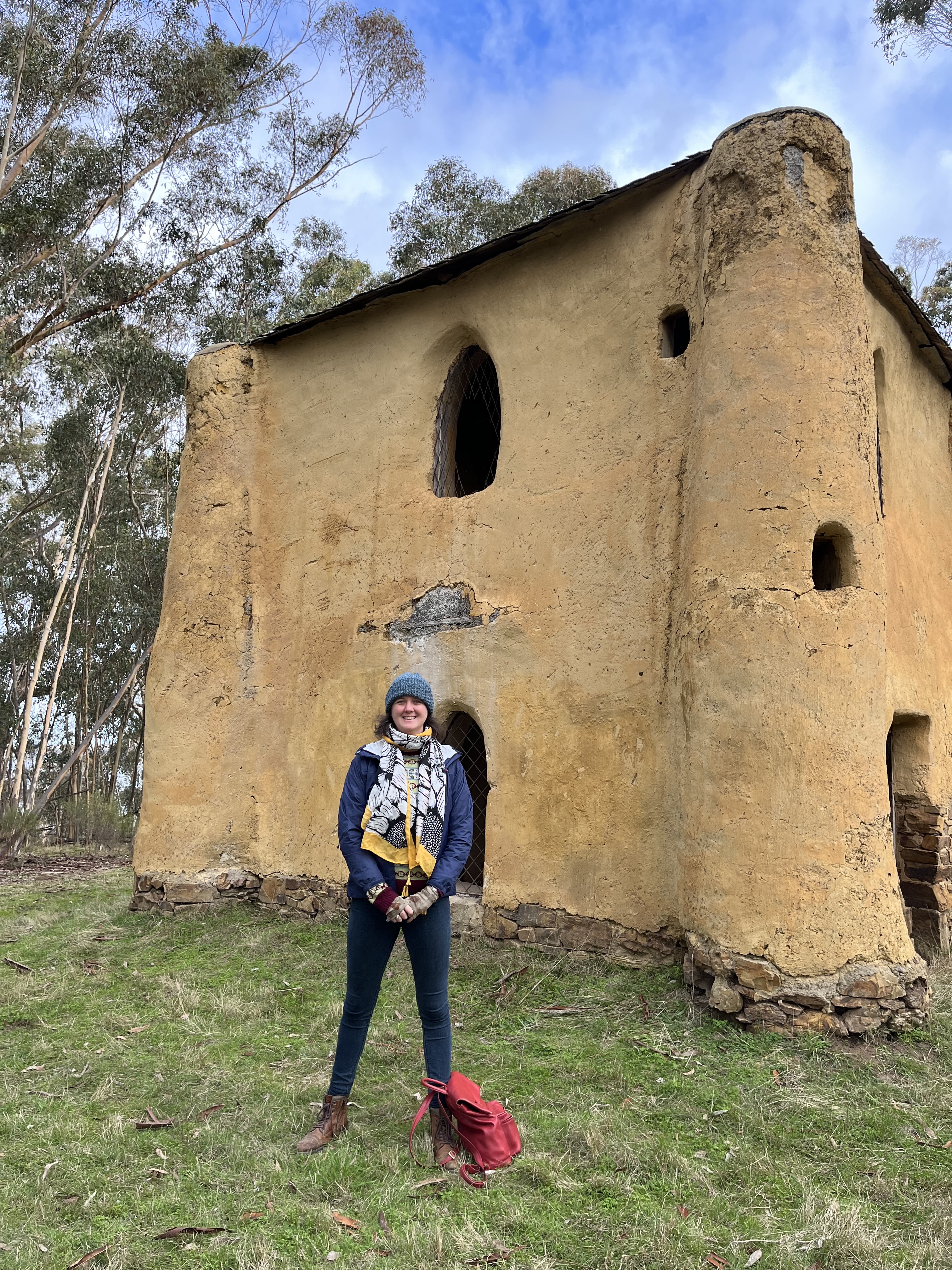


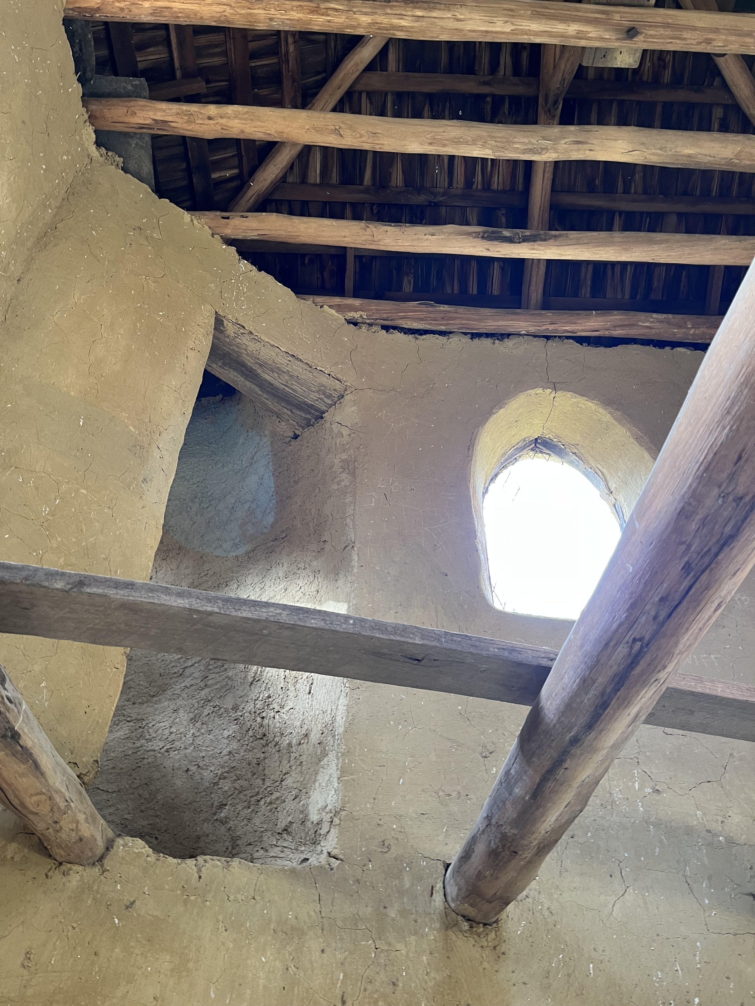

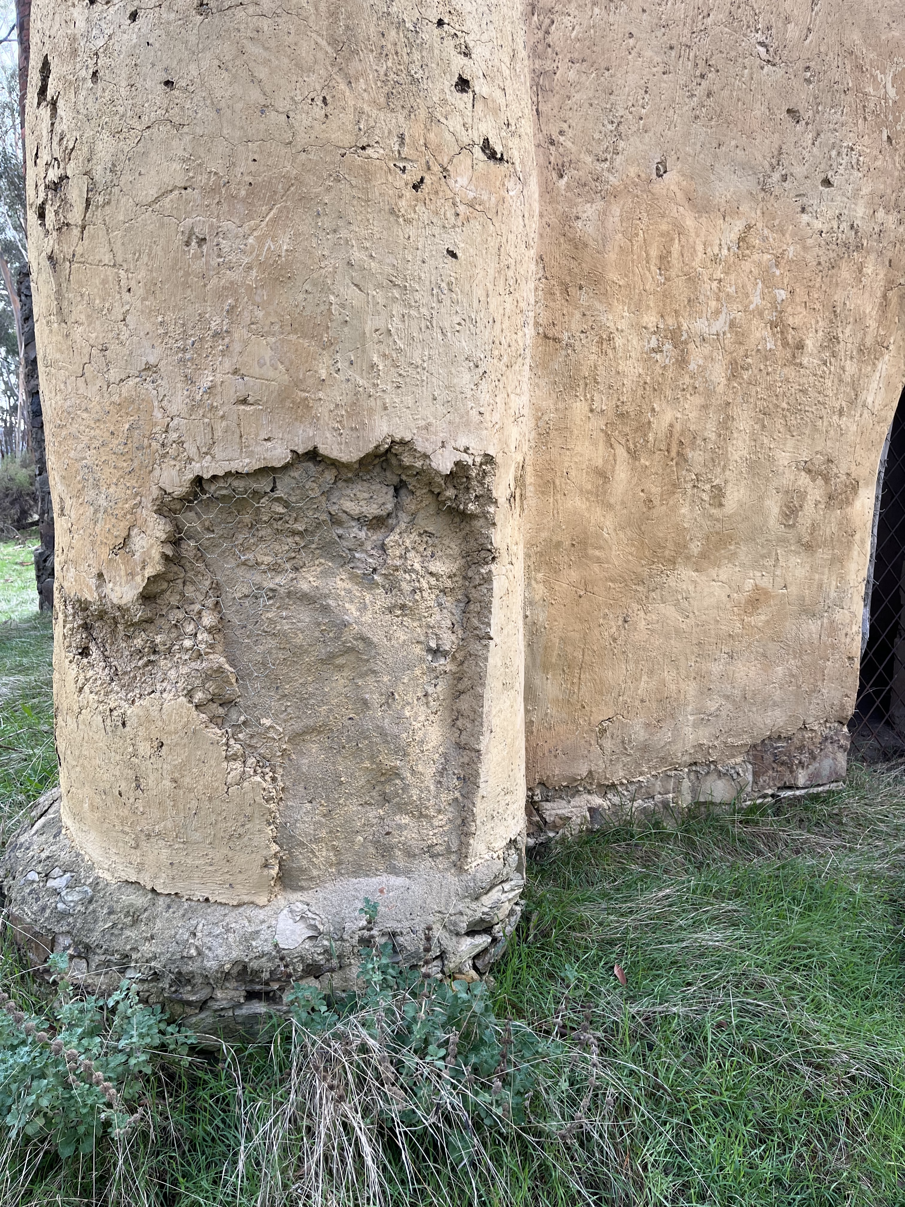


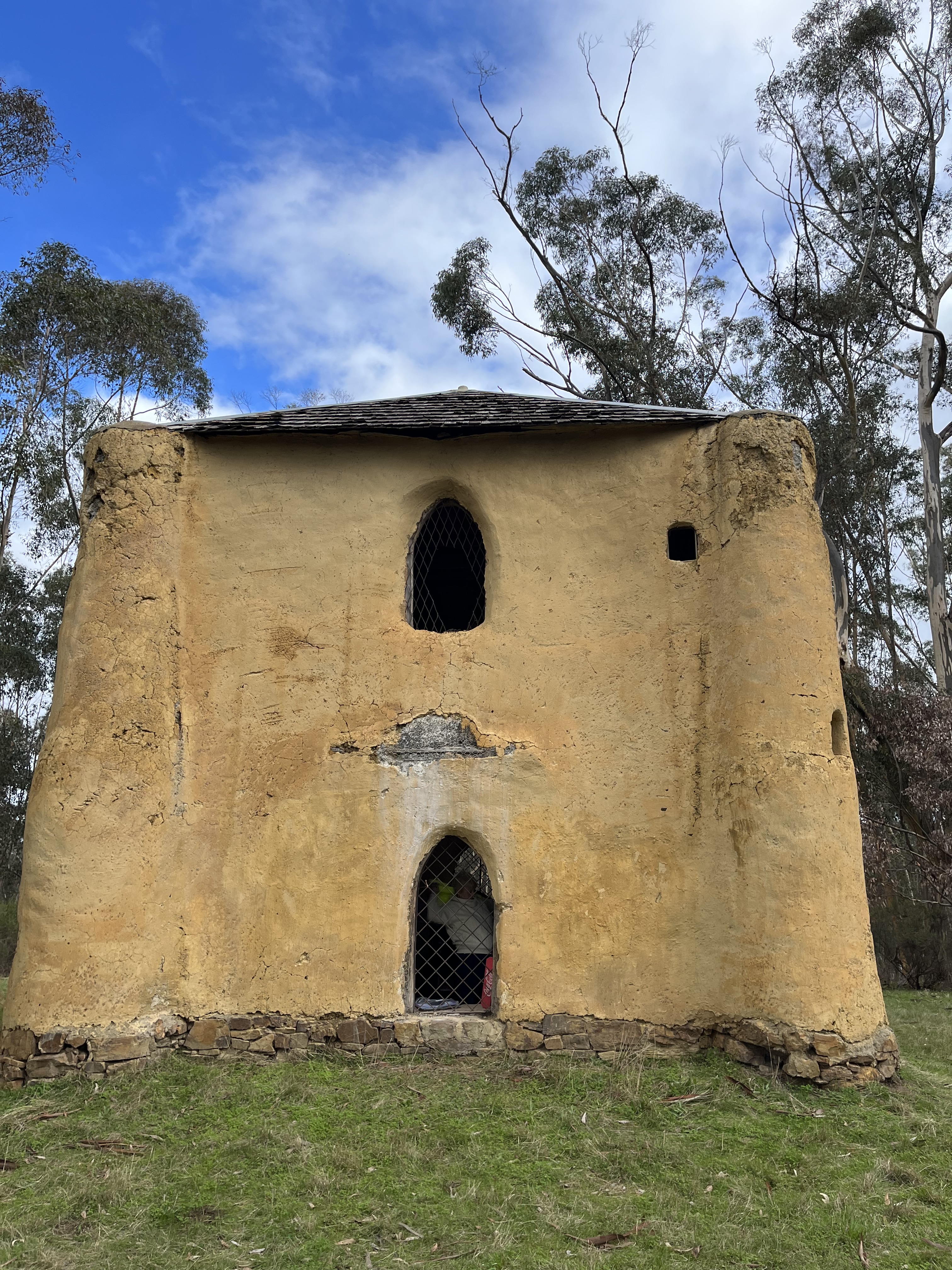


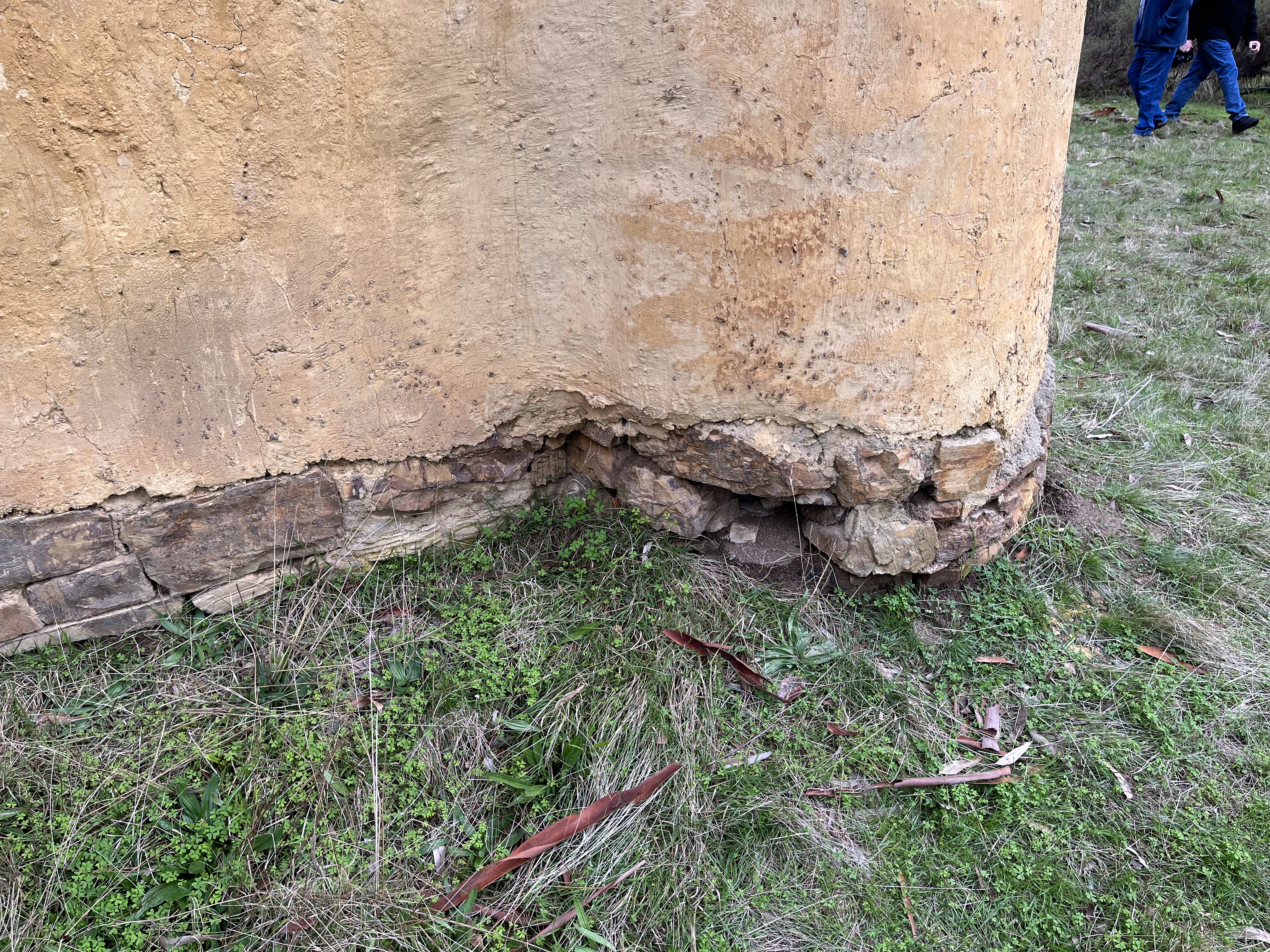

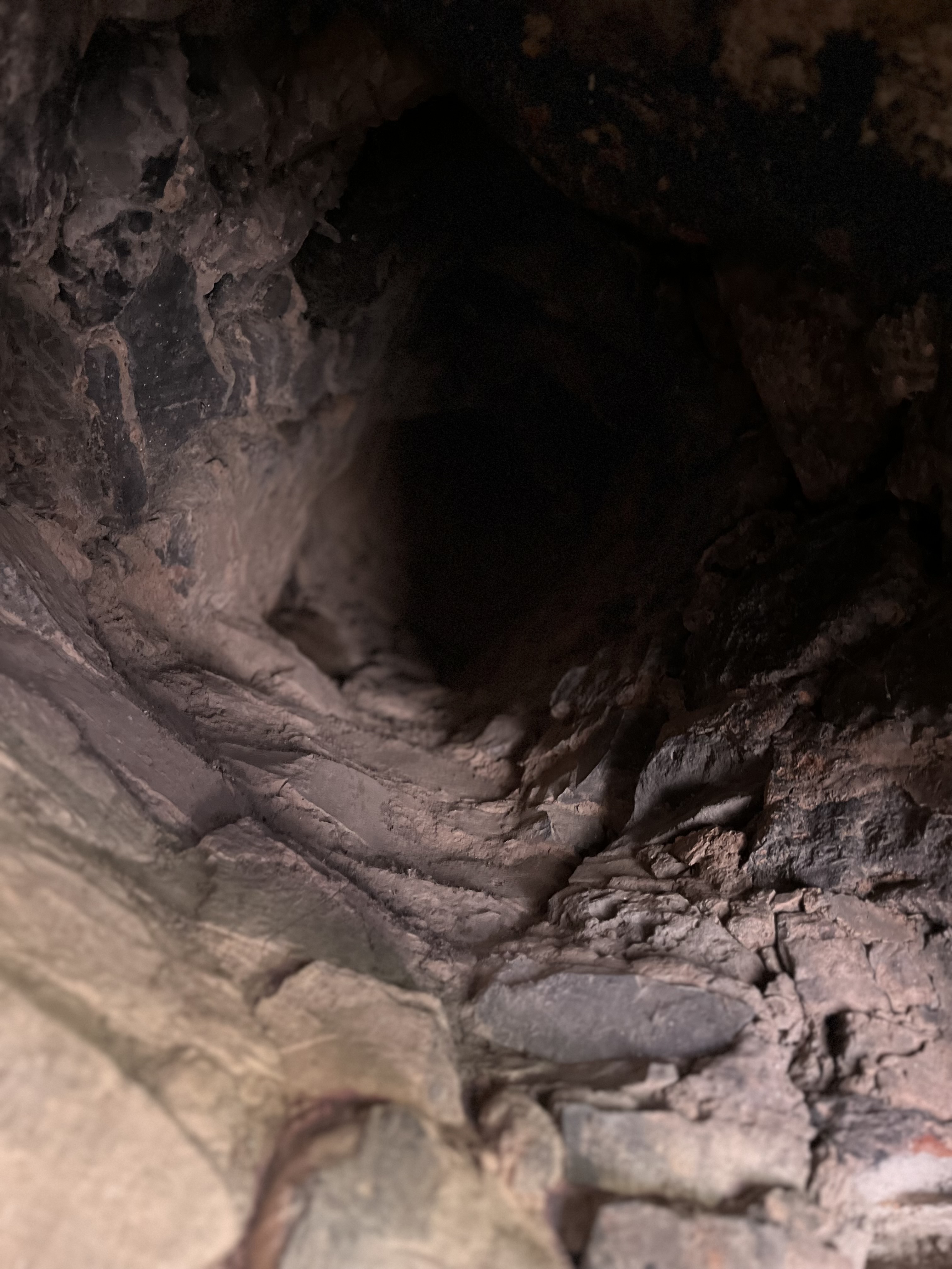


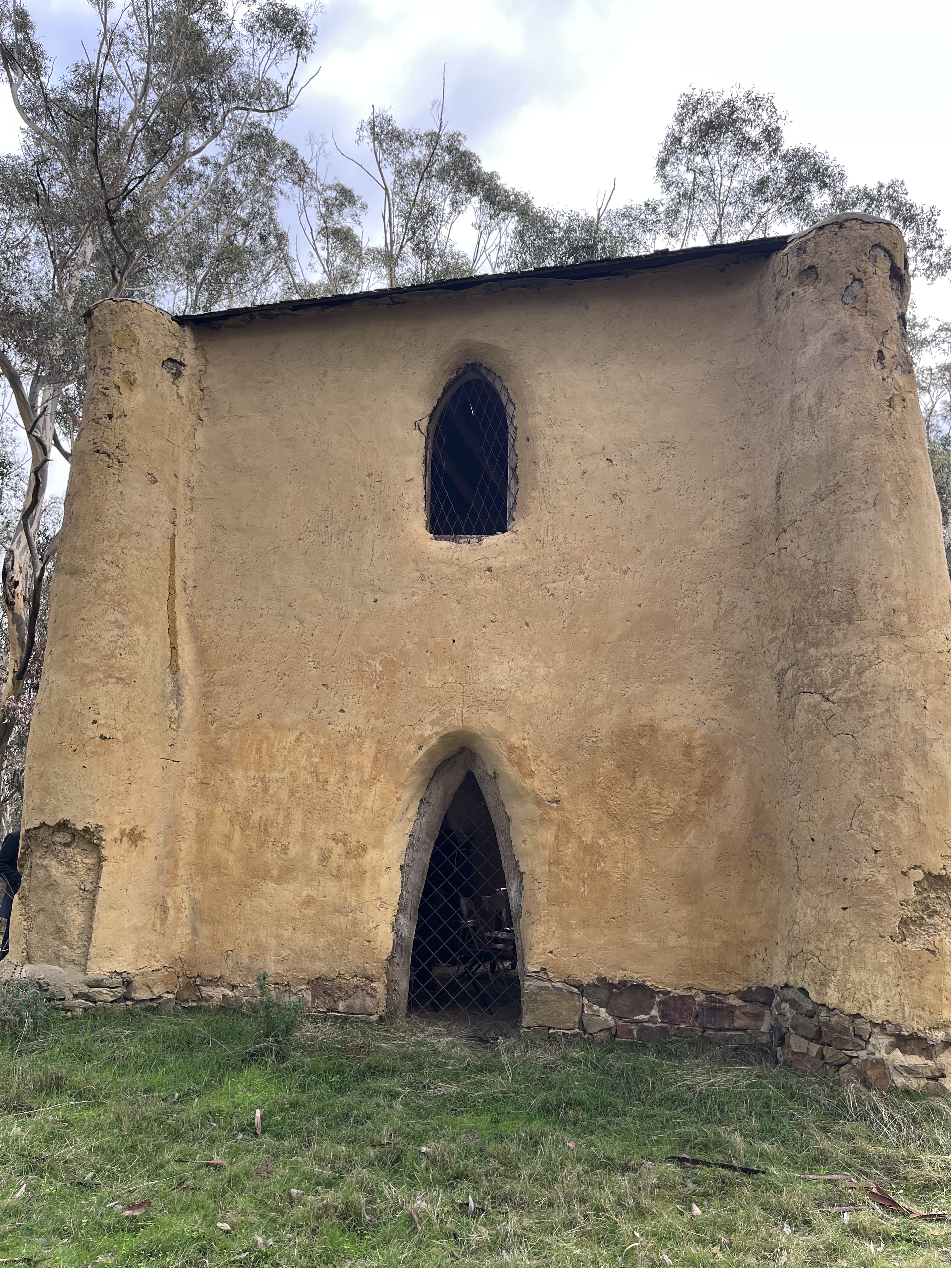
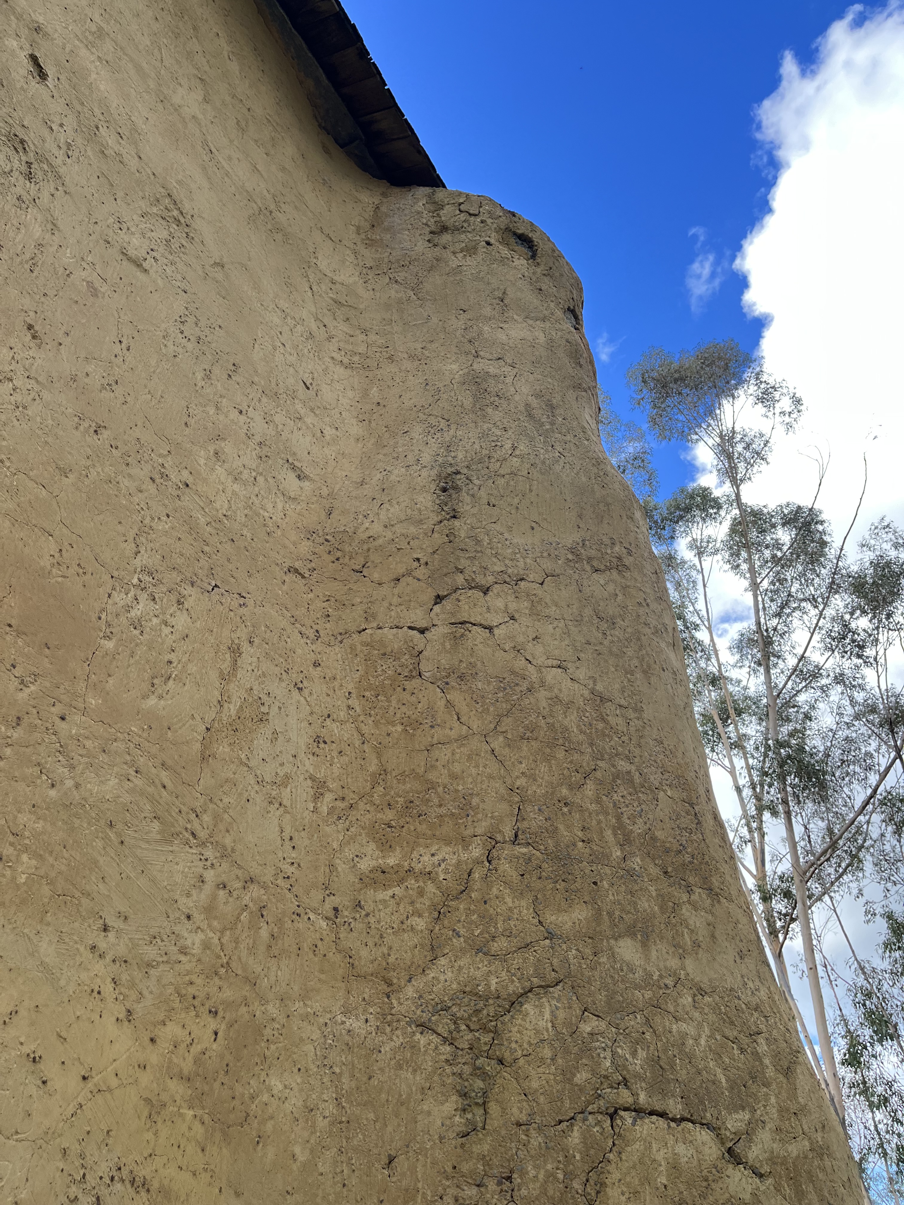


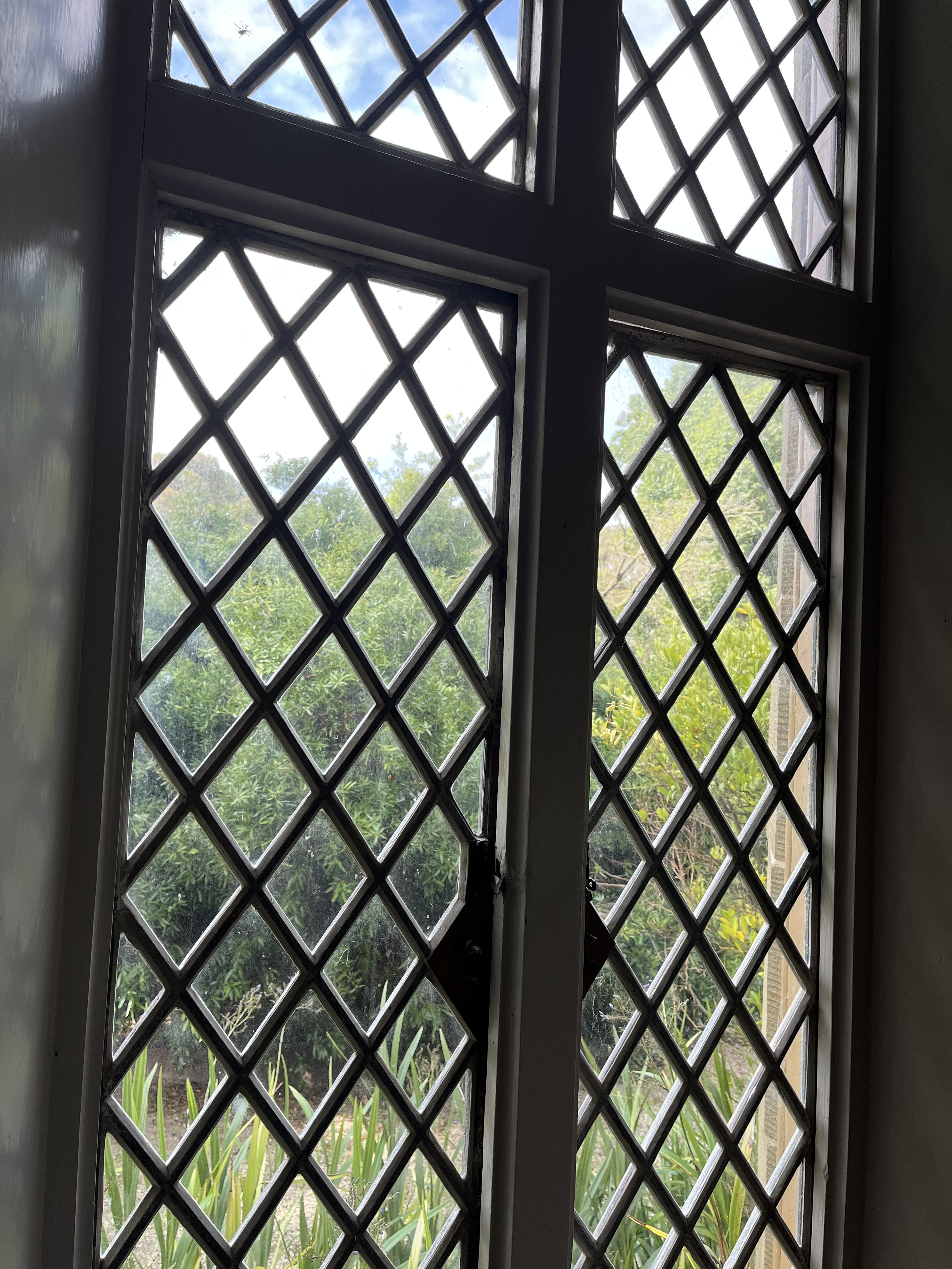


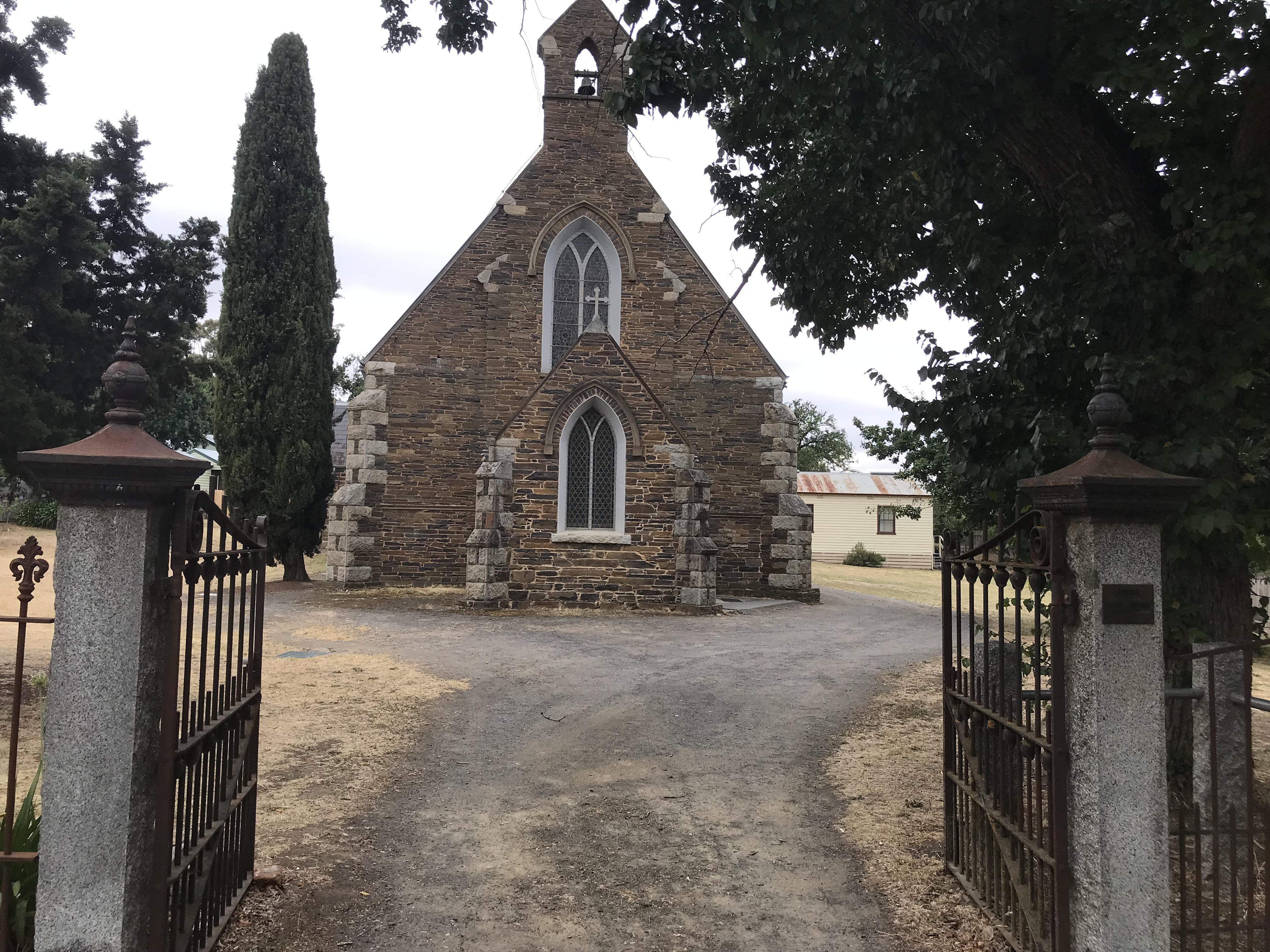
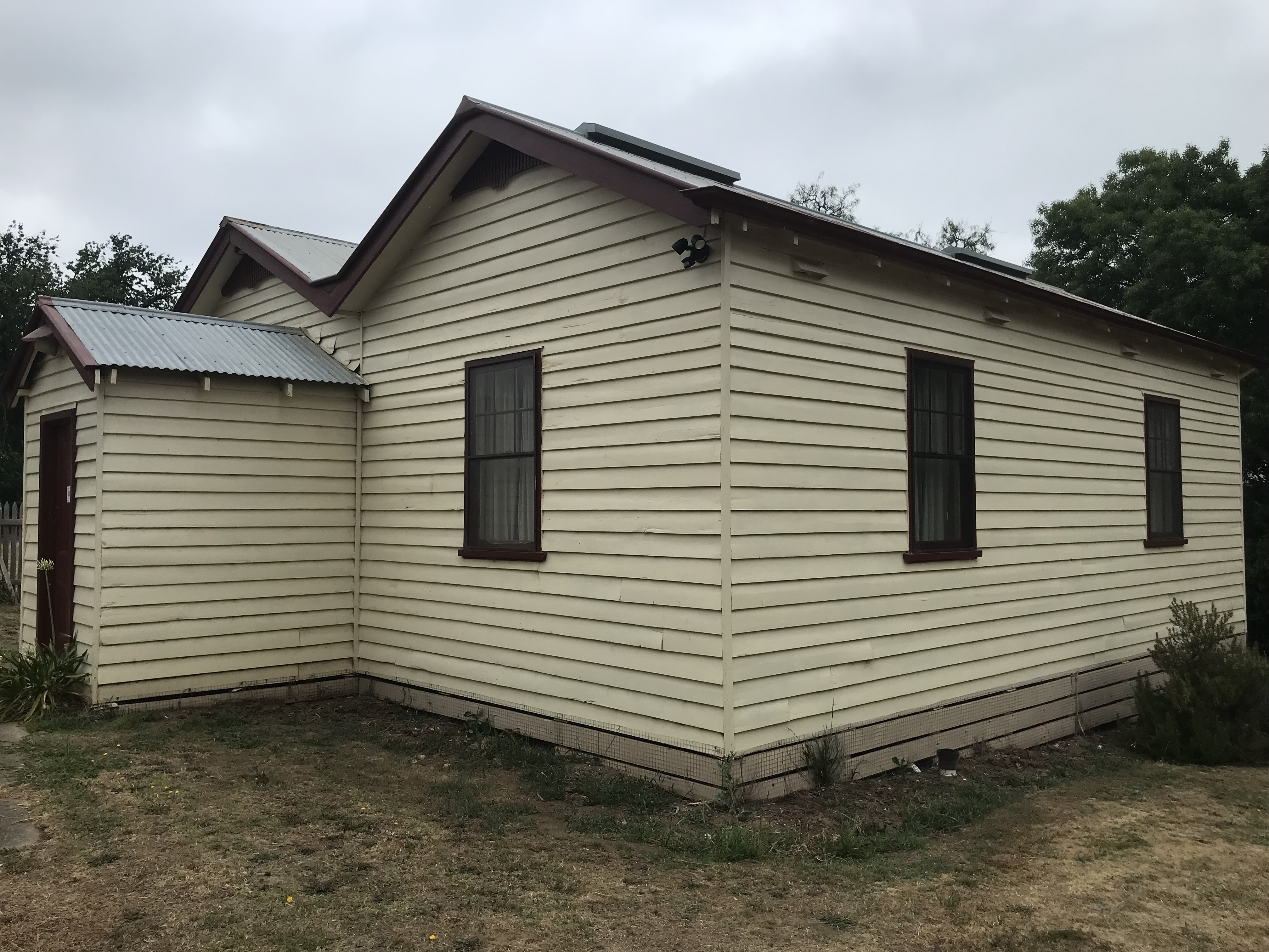


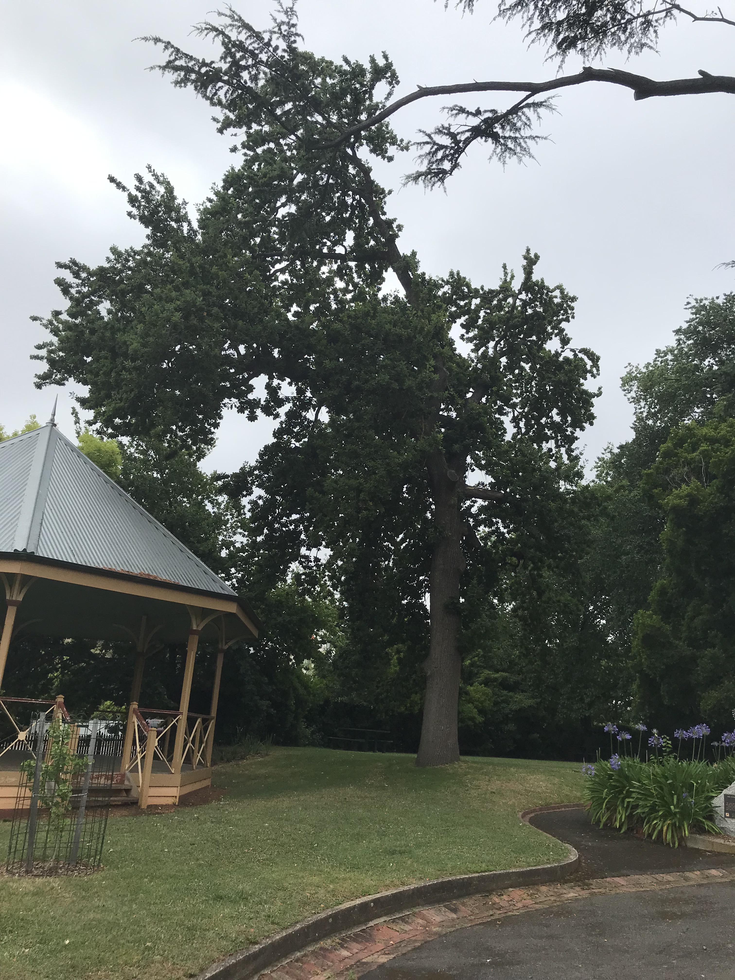


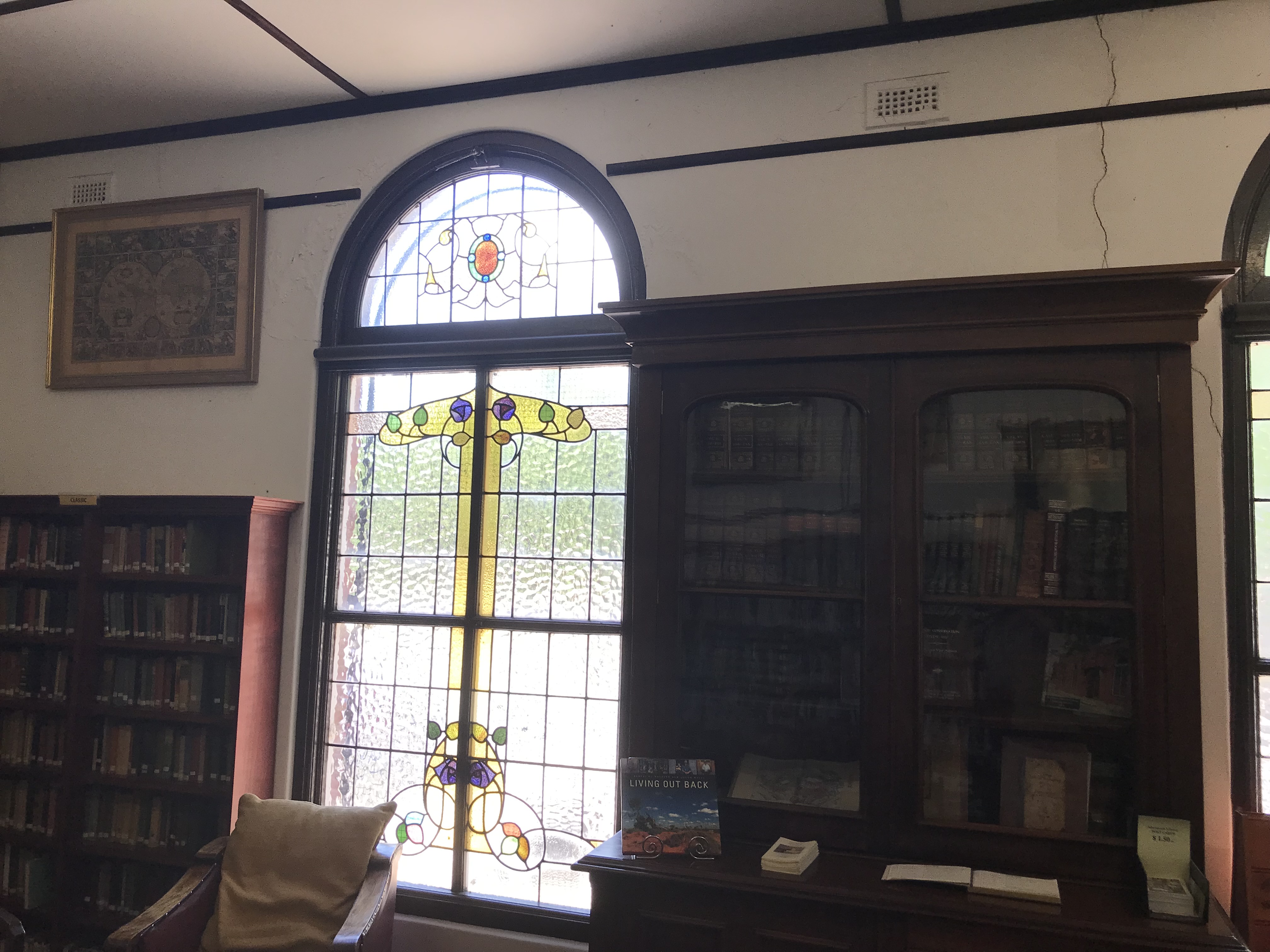
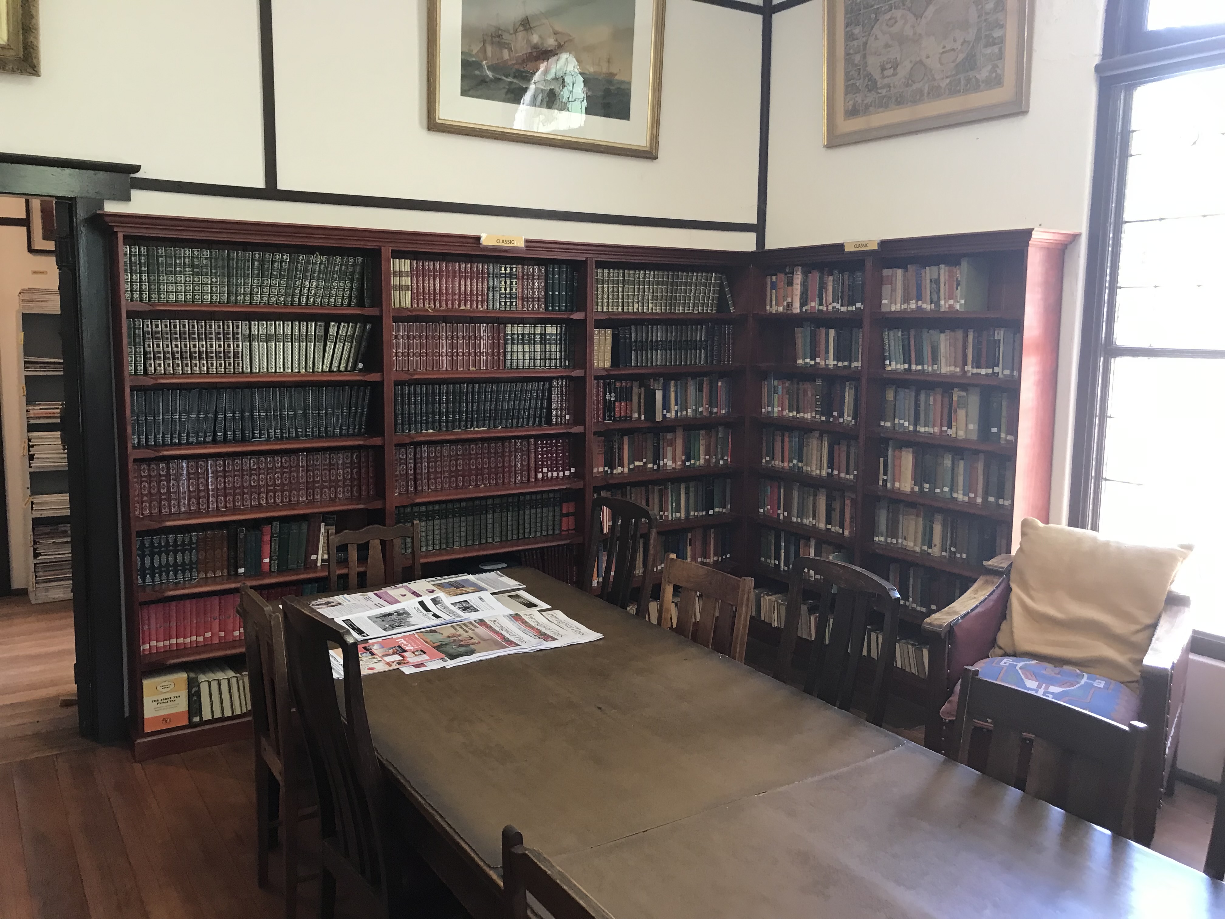

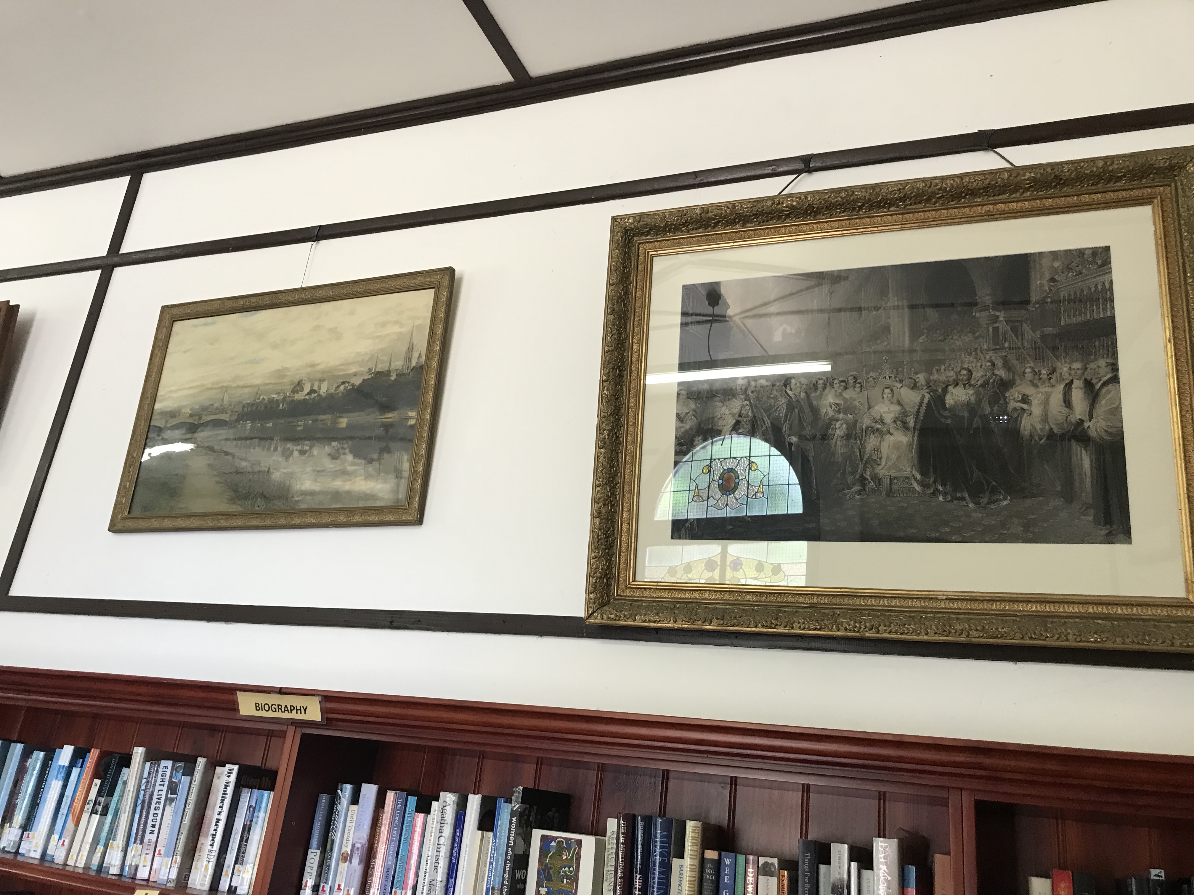

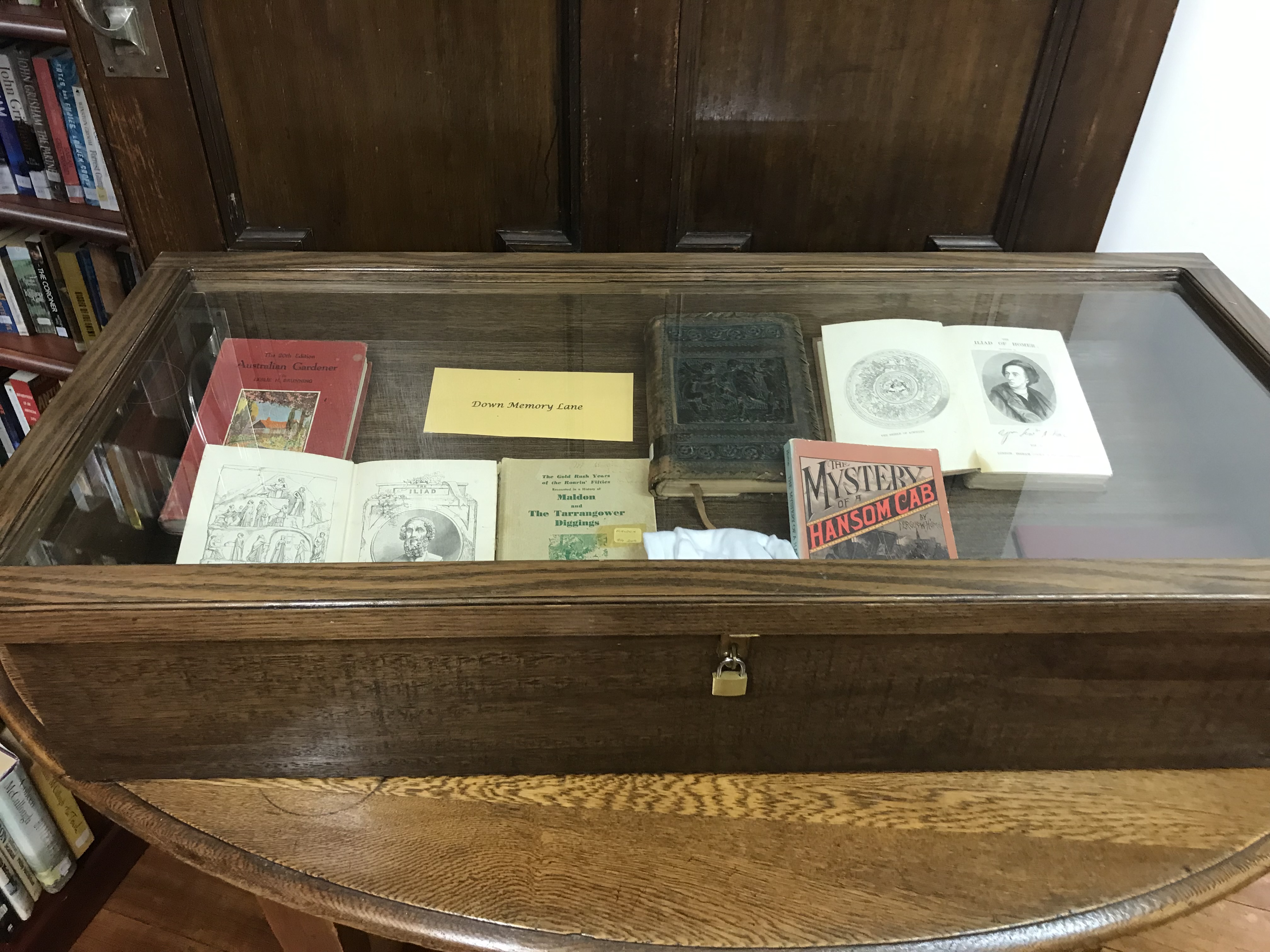


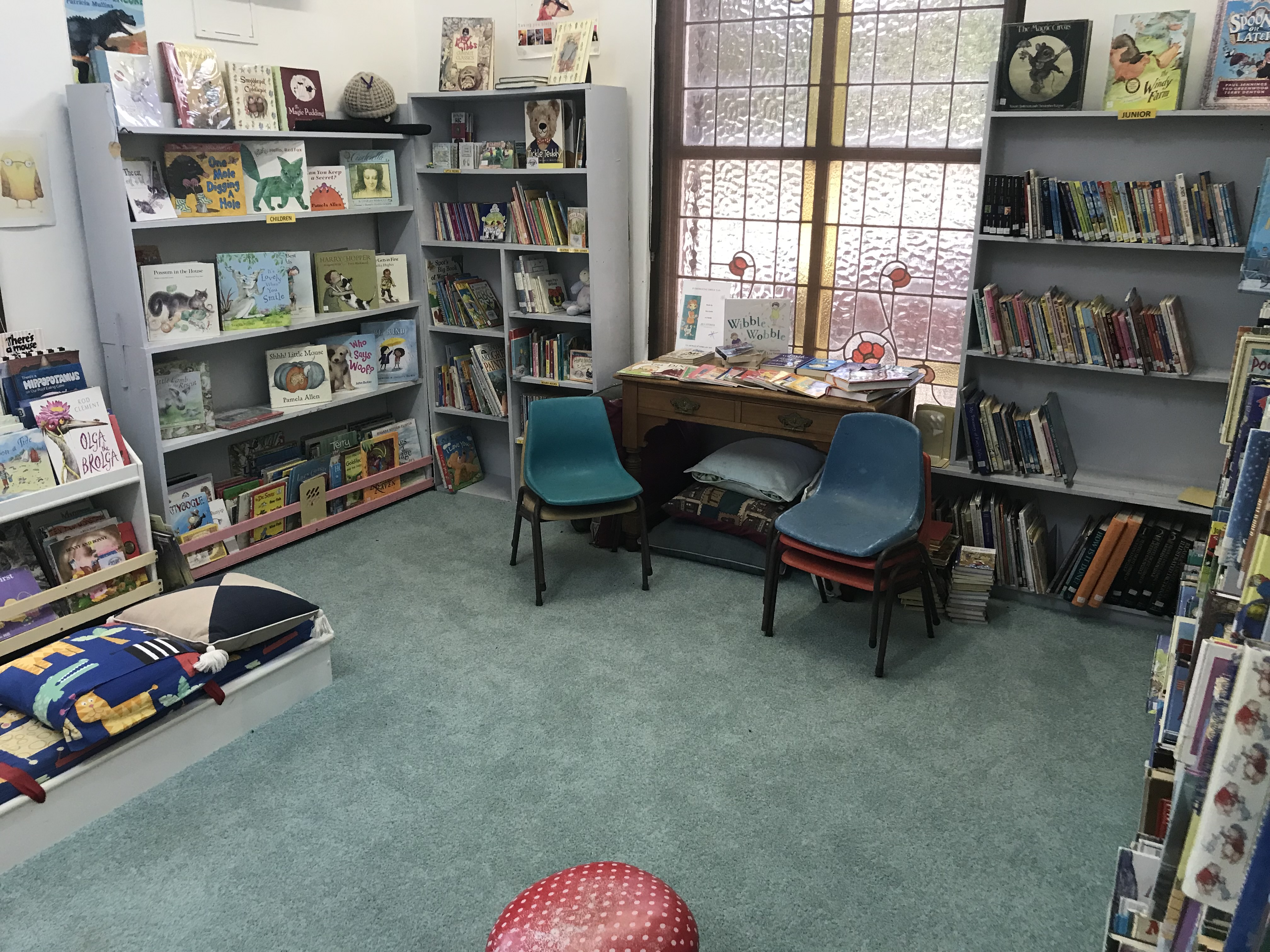


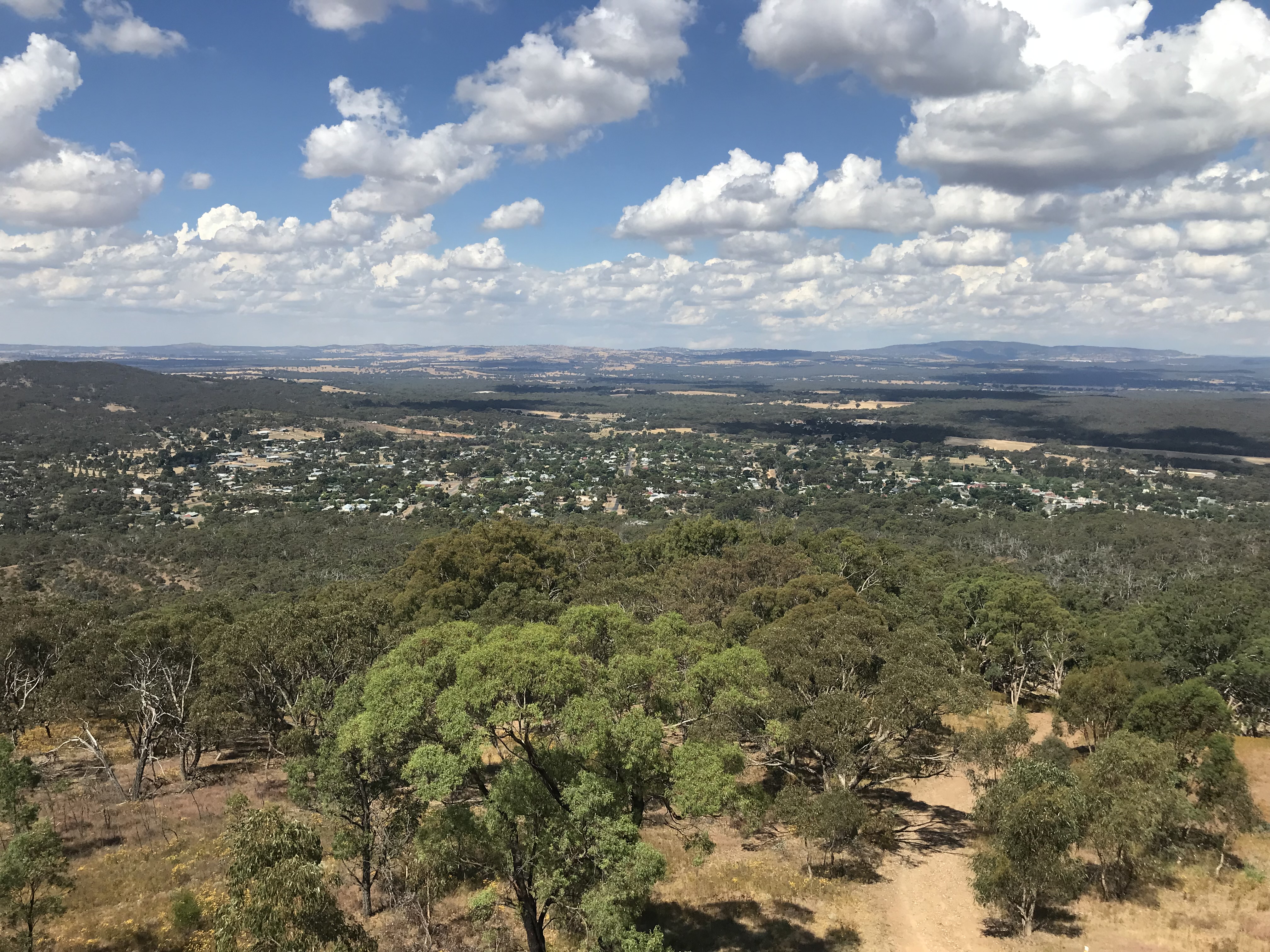
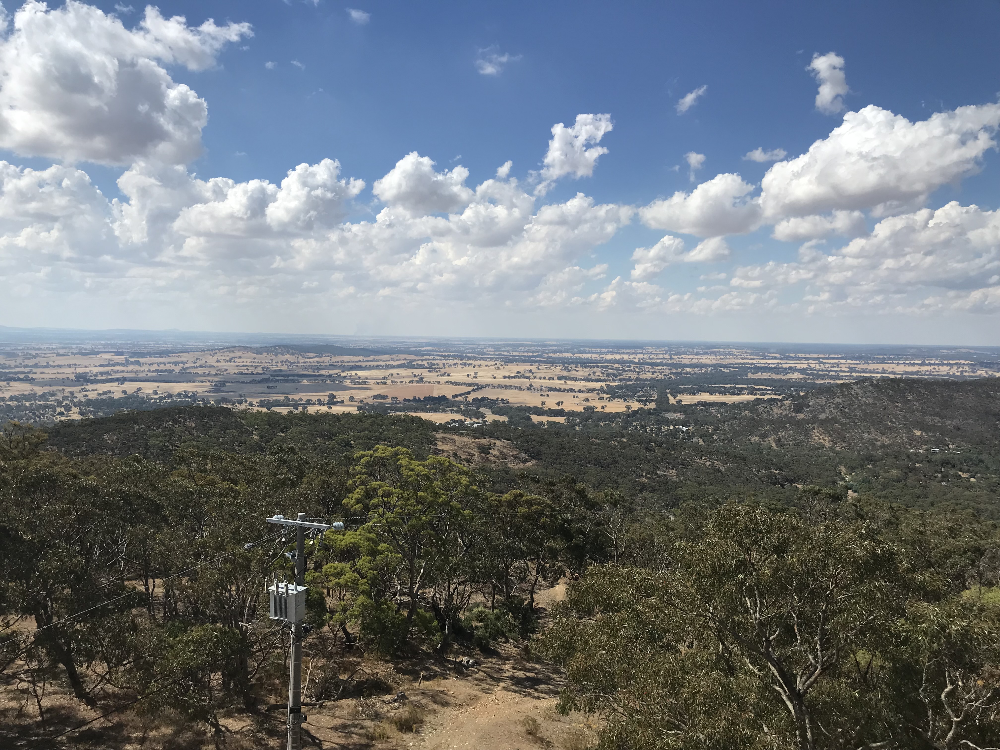
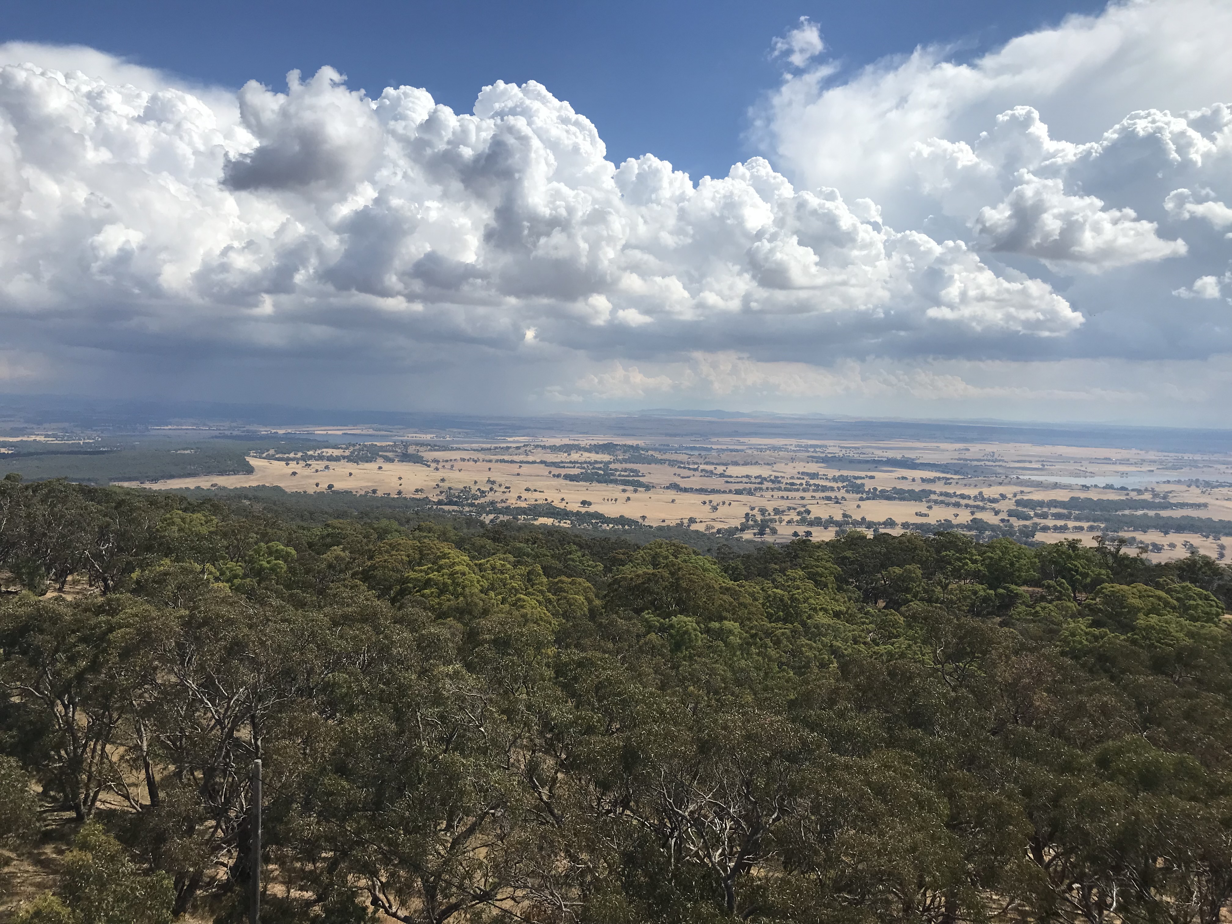
